
Maps, Artifacts, Prints
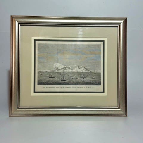
View of the mountains at the Cape of Good-Hope, covered with Clouds on the South East. – Heath
An interesting view showing the table cloth on Table Mountain. Image size 25.2 x 20 cm. Framed size: 43.5 x 37 cm. Very Good. Date Published: Circa 1780 Condition: Very Good.
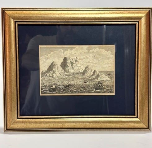
View of the Cape of Good Hope. – Thunderberg, Carl Peter
View of the Cape of Good Hope from travels to Europe, Africa and Asia 1772/1775. Image size: 16.2 x 10.5 cm. Framed size: 32 x 27 cm. Very Good. Date Published: 1795 Condition: Very Good.
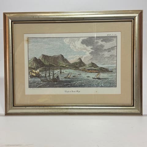
Caap de Goede Hoop. –
View of Cape of Good Hope, 20th century. Size: Plate 32 x 20.5 cm. Framed size: 46 x 34.5 cm. Reprint. Very Good. Condition: Very Good.

The Pilchard Seiners – Watercolour – Rheam, Henry M.
This Quaker artist was a member of the Newlyn Group in Cornwall. Favouring watercolour he is known for his distinctively pre-Raphaelite style. Exhibited at the Royal Academy and elected to the R.B.A. and R.I. in 1892 and 1899. In original frame with label to the verso from James Lanham, St. Ives, artists’s supplies and the…

Johannesburg Cityscape at Night – Larry Scully (1922 – 2002)
South African artist and art educator. He was the first in South Africa to receive a Masters in Fine Art. Going on to teach at Polly Street and WITS before becoming Professor of Fine Art at Stellenbosch University. This work is from arguably his most successful time as a painter, 1969. Esme Burman writes: “ he…

De Cust van Barbaria, Gualata, Arguyn, en Gene: heo, van Capo S. Vincente tot Capo Verde. – Goos, Pieter
Copperplate engraving, hand coloured. This sea chart by Pieter Goos, De Cust van Barbara, Gualata, Arguyn, en Gene, represents a detailed portion of the northwest coast of Africa, focusing on the Saharan and Mauritanian littoral. It covers the coastline from roughly Cape Bojador (Barbary Coast) southward through Gualata (Walata), Arguin, and Gene (Senegal region)an area…
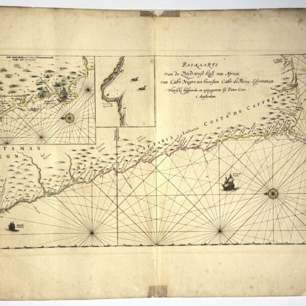
Pas-Kaarte van de Zuyd-west-kust van Africa, van Cabo Negro tot beoosten Cabo de Bona Esperanca – Goos, Pieter
Copperplate engraving with original hand colour. Language: Dutch. This sea chart, drawn and published by the prominent Amsterdam cartographer Pieter Goos, presents the southern segment of the west coast of Africa, extending from Cabo Negro (modern-day Angola-Namibia border) southward to Cabo de Bona Esperanca (Cape of Good Hope). The Pas-Kaarte van de Zinder-west-kust van Africa…

North America –
Lithographed map. Sheet size: 61 x 44cm. Double sheet with central fold. good. Publisher: A & C Black Date Published: circa 1856 Publication Place: London

England and Wales –
Lithographed map. Two sheets, 61 x 44cm each. Total map size 61 x 88cm very good. Splitting at he central fold Publisher: A & C Black Date Published: circa 1856 Publication Place: London

British America. Containing the Discoveries in the Arctic Seas up to 1856 –
Lithographed map. Sheet size: 61 x 44cm. Double sheet with central fold. good. Tide marks to the lower edge. Publisher: A & C Black Date Published: circa 1856 Publication Place: London

Eastern Frontier of the Colony of the Cape of Good Hope… – Arrowsmith, John
This is the first edition of Arrowsmith’s fine map of the Eastern Frontier – it was followed by editions in 1848 and 1851. The impetus for these maps was doubtless the outbreak of two major periods of hostility: the Seventh Frontier War (War of the Axe 1846-1848) and the Eighth Frontier war (1850-1853). This, Arrowsmith’s…

France in Provinces –
Lithographed map. Sheet size: 33 x 44cm good. Publisher: A & C Black Date Published: circa 1856 Publication Place: London
Mexico, California & Texas –
Lithographed map. Sheet size: 33 x 44cm very good. Publisher: A & C Black Date Published: circa 1856 Publication Place: London

Austrian Dominions –
Lithographed map. Sheet size: 33 x 44cm good. Publisher: A & C Black Date Published: circa 1856 Publication Place: London

Sweden & Norway –
Lithographed map. Sheet size: 33 x 44cm very good. Tide mark to lower right Publisher: A & C Black Date Published: circa 1856 Publication Place: London

Turkey in Europe –
Lithographed map. Sheet size: 33 x 44cm very good Publisher: A & C Black Date Published: circa 1856 Publication Place: London

Greece –
Lithographed map. Sheet size: 33 x 44cm very good Publisher: A & C Black Date Published: circa 1856 Publication Place: London
Turkey in Asia –
Lithographed map. Sheet size: 33 x 44cm fair. Foxed Publisher: A & C Black Date Published: circa 1856 Publication Place: London

Ireland –
Lithographed map. Sheet size: 61 x 44cm. Double sheet with central fold. Showing railways, coach and carriage roads, cross roads and steamer routes. very good Publisher: A & C Black Date Published: circa 1856 Publication Place: London

Central Chile and Chili, La Plata or the Argentine Republic & Bolivia –
Lithographed map. Sheet size: 61 x 44cm. Double sheet with central fold. very good Publisher: A & C Black Date Published: circa 1856 Publication Place: London

North & South Wales –
Lithographed map. Sheet size: 61 x 44cm. Double sheet with central fold. Showing railways, coach and carriage roads, cross roads and steamer routes. very good Publisher: A & C Black Date Published: circa 1856 Publication Place: London

France in Departments –
Lithographed map. Sheet size: 61 x 44cm. Double sheet with central fold. very good Publisher: A & C Black Date Published: circa 1856 Publication Place: London

Canada, New Brunswick, Nova Scotia &c. (east sheet) –
Lithographed map. Sheet size: 61 x 44cm. Double sheet with central fold. very good Publisher: A & C Black Date Published: circa 1856 Publication Place: London

Canada (west sheet) –
Lithographed map. Sheet size: 61 x 44cm. Double sheet with central fold. very good Publisher: A & C Black Date Published: circa 1856 Publication Place: London

Douglas Sheet South H 34. Cape of Good Hope- Folding Map – Robinson, Capt. S.M.
Highly detailed linen backed folding map of Douglas and surrounds in the Cape of Good Hope. 8 insets and various other notes and references. Geographical – General Staff. Very good condition 12cm repaired tear to the botom edge. 62 x 65cm Publisher: War Office Date Published: 1913 Publication Place: Cape Town

Germany, Holland, Belgium, with parts of France & Switzerland – Hughes, W
Lithographed map. Sheet size: 61 x 44cm. Double sheet with central fold. Showing the roads, canals and railways. very good Publisher: A & C Black Date Published: circa 1856 Publication Place: London

Cape & Malmesbury Districts – Folding Map – Casgrain, Capt.
Linen backed folding map produced during the Anglo-Boer War. Interesting topographical detail including farm boundaries. 60 x 49cm Publisher: Intelligence Dept. Date Published: 1901 Publication Place: Cape Town

Britstown – Folding Map –
Linen backed folding map. Scale of 3.94 miles to 1 inch. Showing roads, rivers, hills, pans, railways, telegraph line, farm boundries and fences, homesteads, cultivated lands and trees in the key. Some abrasions to the rhight side, wear and fading to the wraps. 62 x 49.5cm. Compiled at the time of the Anglo Boer War….
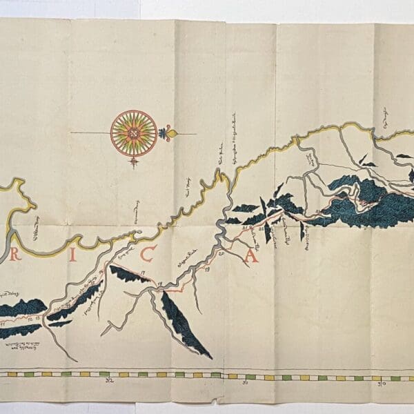
Report upon the Archives of the Cape Colony namely a folding map of the Journey of Simon van der Stel to the Copper Mines in Namaqualand in 1685. – Theal, George M
“An Elaborate Chart of the Journey of Commander Simon van der Stel to the Copper Mines of Namaqualand in 1685, being the first map upon which any indication of the Orange River appears.” The map forms part of a “Blue Book” government publication printed in 1882, when the author, George Theal visited the archives in…
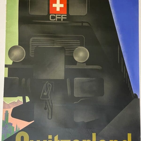
SBB – CFF – Switzerland – best value in holiday travel. Original Poster – Trapp, Willi
Printed with stone lithography for the Swiss National Railway for the celebration of the 50th anniversary of the opening of the Gotthard tunnel in 1932. One 2cm repaired tear to the left edge, otherwise in excellent unrestored condition. Date Published: 1932 Publication Place: Switzerland Condition: Very good.