Maps, Artifacts, Prints
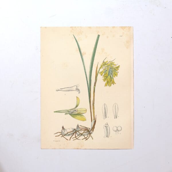
Hand Coloured Plate from The Flowering Plants of South Africa – Eulophia Leontoglossa –
The first 27 volumes 1921 – 1948 had 1080 hand coloured plates. Subsequent volumes have colour lithographed plates. The series is still in publication and is currently on its 70th volume. Each hand coloured plate focuses on a different flowering plant species indigenous to South Africa accompanied by a description of their unique botanical characteristics,…
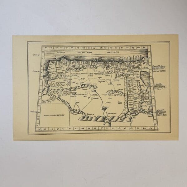
Tertia Africae Tabula – Waldseemuller, Martin
North Africa, originally published c. 1513, this is a 20th century copy. Very good condition, sheet size: 52 x 33cm. Printed on good quality paper. Date Published: c.1950

Barbariae et Biledvlgerid, Nova Descriptio – Ortelius, Abraham
North Africa, originally published c. 1570, this is a 20th century copy. Very good condition, sheet size: 52 x 33cm. Printed on good quality paper. Date Published: c.1950

Antique Sea Chart – Coast of Africa –
Copy of an early masnuscript chart, probably 15th or 16th century, this is a 20th century copy. Very good condition, sheet size: 66 x 52cm. Printed on good quality paper, with a central fold Date Published: c.1950

3 Early Charts of the African Coast –
This is a 20th century copy. Very good condition, sheet size: 66 x 52cm. Printed on good quality paper, with a central fold Date Published: c.1950

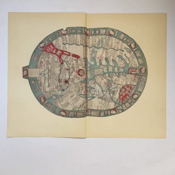
Map of the World – Germanus, Henricus Martellus
The first known map to show the Cape of Good Hope, discovered by Bartholemeu Dias in 1488. This is a 20th century copy. Very good condition, sheet size: 66 x 52cm. Printed on good quality paper, with a central fold Date Published: c.1950

St. Helena Island – Dapper
Published c. 1677, this is a 20th century copy. Very good condition, sheet size: 66 x 52cm. Printed on good quality paper, with a central fold Date Published: c.1950
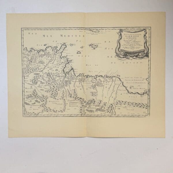
Partie de la Coste de Barbarie en Africque… – Sanson, Nicolas
17th century French map of part of the coast of Barbary showing the kingdoms of Tunis and Trippoli. Originally published in 1655, this is a 20th century copy. Very good condition, sheet size: 66 x 52cm. Printed on good quality paper, with a central fold Date Published: c.1950
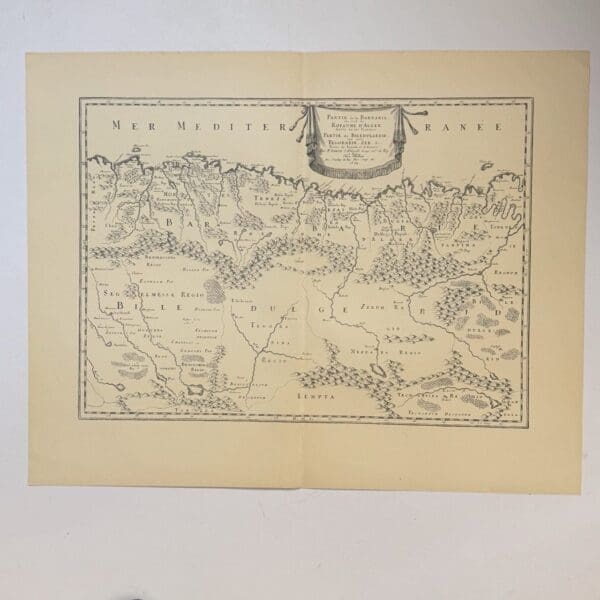
Partie de la Barbarie ou est le Royaume D’Alger – Sanson, Nicolas
The Kingdom of Algiers. Originally published c.1679, this is a 20th century copy..Very good condition, sheet size: 66 x 52cm. Printed on good quality paper, with a central fold Date Published: c.1950
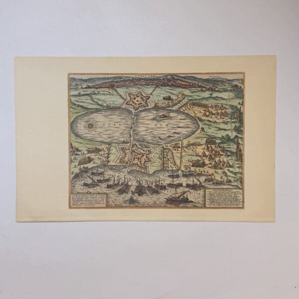
Tunis at La Goulette – Braun, Georg
Copy of an engraving of the Ottoman fleet attacking Tunis at La Goulette in 1574. Originally published in Civitates Orbis Terrarum 1572 – 1617, this is a 20th century copy. Very good condition, sheet size: 52 x 33cm. Printed on good quality paper. Date Published: c.1950
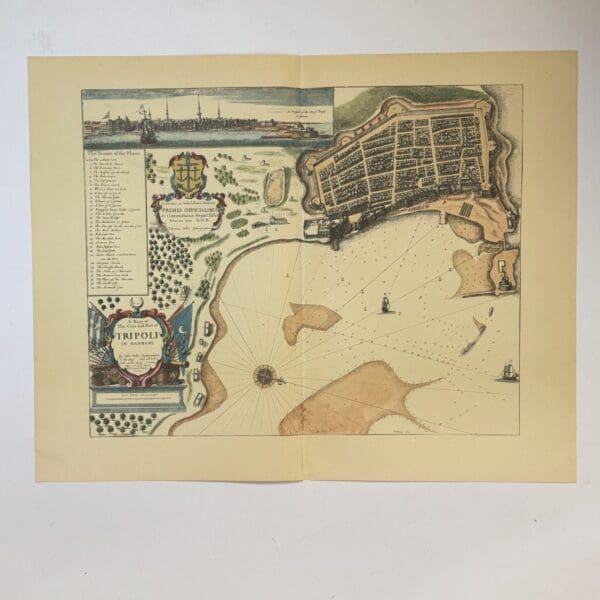
A Mapp of The Citie and Port of Tripoli in Barbary – Seller, John
Originally published c.1675, this is a 20th century copy. Very good condition, sheet size: 66 x 52cm. Printed on good quality paper, with a central fold Date Published: c.1950
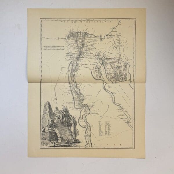
Carte de L’Egypte Ancienn et Moderne. – Vaugondy, Robert de
18th century French map of Ancient Egypt showing the Nile river and its delta. Originally published c. 1753, this is a 20th century copy. Very good condition, sheet size: 66 x 52cm. Printed on good quality paper, with a central fold Date Published: c.1950
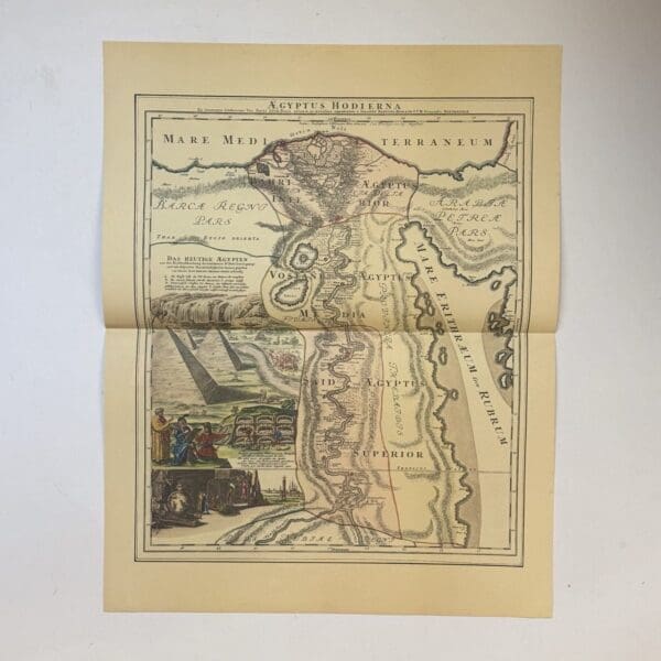
Aegyptus Hodiera – Homann, Johann
German map showing the course of the Nile River with exaggerated detail, based on the travels of Paul Lucas. A French merchant and antiquarian Originally published c. 1753, this is a 20th century copy. Very good condition, sheet size: 66 x 52cm. Printed on good quality paper, with a central fold Date Published: c.1950
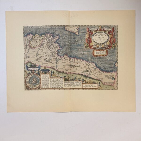
Africae Propriae Tabula – Ortelius, Abraham
Showing ancient North Africa, specifically focusing on the Carthaginian Kingdom during the Punic Wars. Originally published c. 1603, this is a 20th century copy. Very good condition, sheet size: 66 x 52cm. Printed on good quality paper, with a central fold Date Published: c.1950
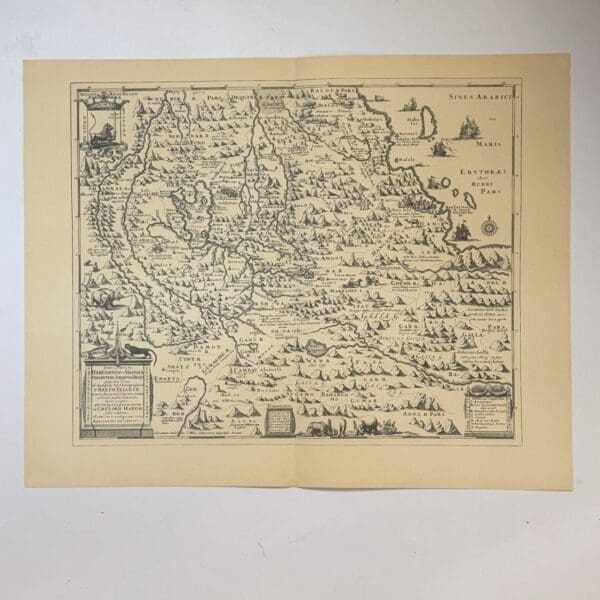
Presbyteri seu Abassia Presbyteri Johannis Regio… – Ludolf, Job
A 17th century map of Abyssinia (Ethiopia), showing the mythical kingdom of Prester John. Based on a chronicle by P Balthazar Tellez. Originally published in 1683, this is a 20th century copy. Very good condition, sheet size: 66 x 52cm. Printed on good quality paper, with a central fold. Date Published: c.1950

Carte De La Barbarie De La Nigritie Et De La Guinee – L’Isle, Guillaume
Map of North Africa and the Barbary Coast. Originally published c. 1707, this is a 20th century copy. Very good condition, sheet size: 66 x 52cm. Printed on good quality paper, with a central fold Date Published: c.1950
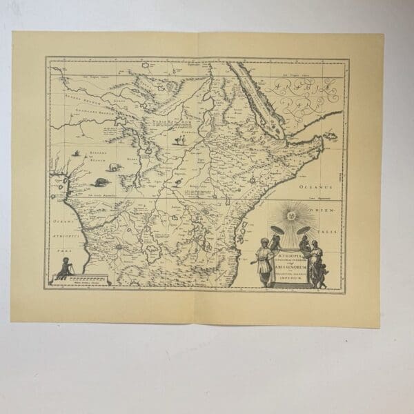
Aethiopia Superior vel Interior vulgo Abissinorum sive Presbiteri Ioannis Imperium – Blaeu, Willem Janzoon
A 17th century map of Ethiopia, originally published c. 1640, this is a 20th century copy. Very good condition, sheet size: 66 x 52cm. Printed on good quality paper, with a central fold. Date Published: c.1950

Nova Barbariae Descriptio – Schenk and Valk
Map of North Africa – Description of Barbary. Originally published c. 1700, this is a 20th century copy. Very good condition, sheet size: 52 x 33cm. Printed on good quality paper. Date Published: c.1950
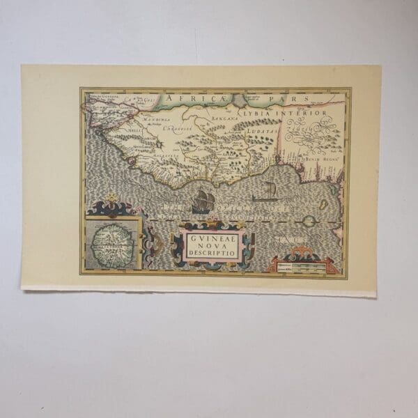
Guineae Nova Descriptio – Hondius, Jodocus
A 17th century map depicting the Gulf of Guinea, extending from modern day Gambia to the coasts of Camaroon and Gabon. Originally published c. 1614, this is a 20th century copy. Very good condition, sheet size: 52 x 33cm. Printed on good quality paper. Date Published: c.1950

Carte Particuliere de la Coste D’Or – Bellin, Nicolas
Map of the Gold Coast of Africa, now part of modern day Ghana. Originally published in 1750, this is a 20th century copy. Very good condition, sheet size: 66 x 52cm. Printed on good quality paper, with a central fold. Date Published: c.1950
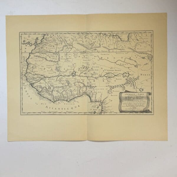
L’Afrique, ou Lybie… – Sanson, Nicolas
Map of North Western Africa and Lybia. Originally published c. 1600, this is a 20th century copy. Very good condition, sheet size: 66 x 52cm. Printed on good quality paper, with a central fold. Date Published: c.1950
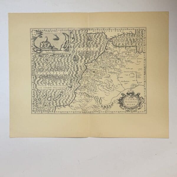
Fessae et Marocchi Regna – Mercator, Gerardus
A 15th century map of the kingdoms of Fez and Morocco. Originally published c. 1620, this is a 20th century copy. Very good condition, sheet size: 66 x 52cm. Printed on good quality paper, with a central fold. Date Published: c.1950
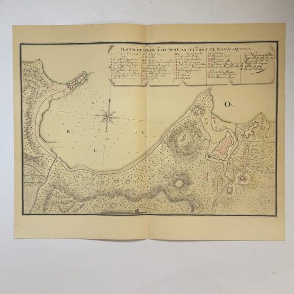
Fessae et Marocchi Plan de Oran y de Sus Castellos y de Masalquivir – Mercator, Gerardus
Copy of a manuscript map of Oran and its castles, and of Mazalquivir, located in present-day Algeria. Likely produced in the 18th century, this is a 20th century copy. Very good condition, sheet size: 66 x 52cm. Printed on good quality paper, with a central fold. Date Published: c.1950

Plan of Algiers – Braun, Georg
Plan of the city of Algiers from the Civitates Orbis Terrarum, a town atlas originally published between 1572 and 1617 This is a 20th century copy. Very good condition, sheet size: 52 x 33cm. Printed on good quality paper. Date Published: c.1950
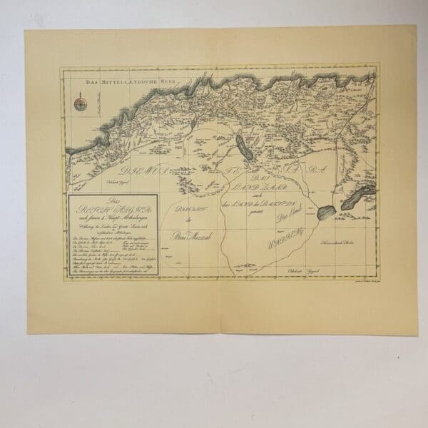
Das Reich Algier –
A German map of the Kingdom of Algiers. Originally published in 1798, this is a 20th century copy. Very good condition, sheet size: 66 x 52cm. Printed on good quality paper, with a central fold. Date Published: c.1950

Hand coloured steel engraving from The Natural History of Humming-Birds – Plate 15 – Trochilus Tricolor – Jardine, William
Original hand coloured steel engraving, published in 1833. Sheet size: 10.4 x 16.4cm Condition: very good. Publisher: Lizars Date Published: 1833 Publication Place: Edinburgh First Edition: Yes
14th Century Map from the Polychronicon – Higden, Ranulf
A 20th century copy. The original was drawn c.1539. Very good condition, sheet size: 66 x 52cm. Printed on good quality paper, with a central fold. Date Published: c.1950 Condition: Very good condition
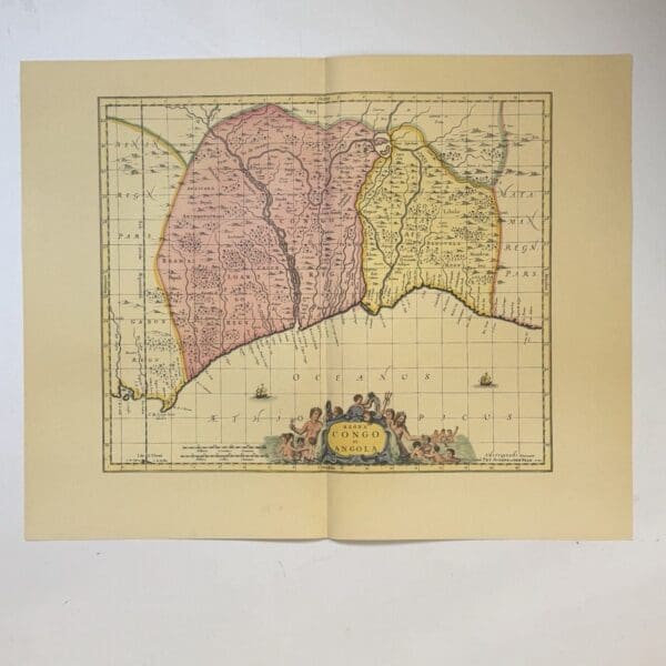
Regna Congo et Angola – Schenk
A 17th century map of Congo and Angola. A 20th century copy. The original was first published in 1660 and re-issued many times. Very good condition, sheet size: 66 x 52cm. Printed on good quality paper, with a central fold. Date Published: c.1950
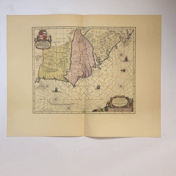
Genehoa, Jaloffi, et Sierraliones Regna – Jansson, Jan
A nautical chart of the West African coast. Covering from Senegal to Sierra Leone, with a focus on the area around the Gambia River. Originally published c. 1665, this is a 20th century copy. Very good condition, sheet size: 66 x 52cm. Printed on good quality paper, with a central fold. Date Published: c.1950
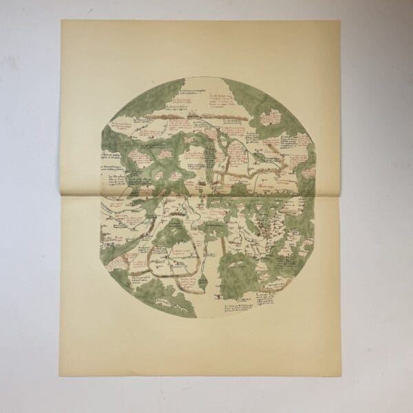
The Zeitz World Map –
A circular mappa mundi believed to be from the late 15th century. This is a 20th century copy. Very good condition, sheet size: 66 x 52cm. Printed on good quality paper, with a central fold. Date Published: c.1950