Founded in 1990, family-owned Quagga Books has built a distinctive footprint in the antiquarian book trade with our eye for the unusual.
For an authentic experience, visit our Kalk Bay shop or browse through our interesting mix of books, maps and ephemera on our website.
We ship worldwide using a secure airmail process.
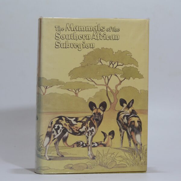
The Mammals of the Southern African Subregion – Smithers, Reay H N
Emphasis on the distribution of species, type of habitat, characteristic habits, their food and reproduction. 30 full colour plates with numerous b&w drawings illustrating the text. 736 Pages. Mild thumbing. Light foxing to page edges. Previous owner’s name to fep. First edition. Condition: very good. Dust jacket: very good, hardcover. Publisher: University of Pretoria Date…
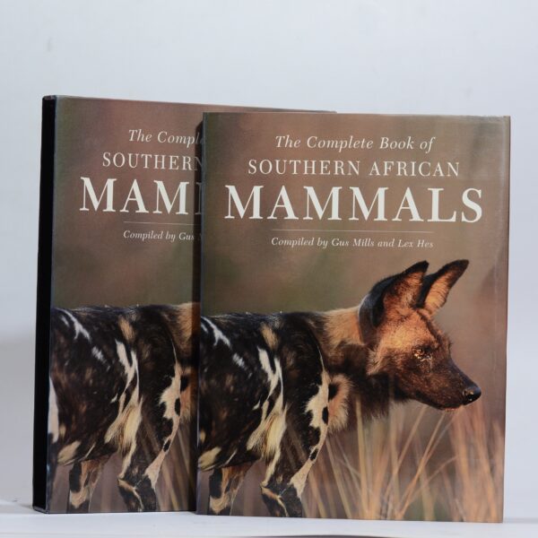
The Complete Book of Southern African Mammals – Mills, Gus and Hes, Lex (comp.)
Illustrated on every page with colour photographs and distribution maps. Very good condition in a slipcase. Publisher: Struik Winchester Date Published: 1997 Publication Place: Cape Town First Edition: Yes Condition: very good Has Dust Jacket: Yes Jacket Condition: very good
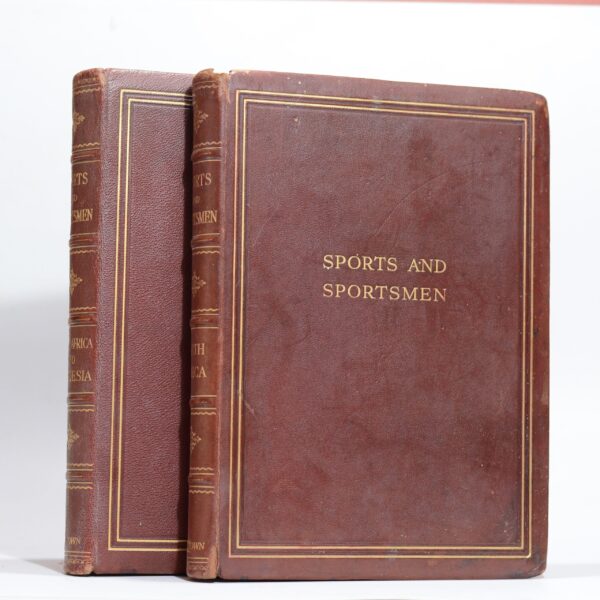
Sports and Sportsmen. South Africa and Rhodesia (2 vols.) – Cape Times (comp.)
Number 470 of 500 copies. Lavishly produced in a full pebbled morocco binding with gilt titles, ruling and dentilles. Crimson and gold marbled endpapers. Inscription to the Rhodesia volume. Very good condition with signs of edgewear and age toning. Heavy set Publisher: Atkinson & Partners Date Published: 1929 Publication Place: Cape Town Dimensions: 29 x…
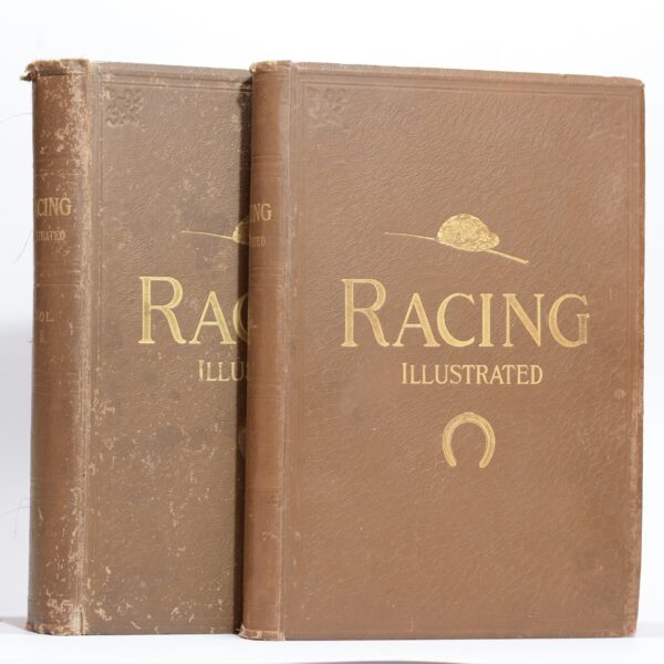
Racing Illustrated. Vols II and III. With Sire Abe Bailey –
Volume II is December 1895 to June 1896 (no’s 23 to 52) and volume III is July 1896 to December 1896 (no’s 53 to 79). Both volumes bear the bookplate of Sir Abe Bailey to the front paste down. Bound volumes of this illustrated horse racing journal. Condition good to fair: volume II missing the…
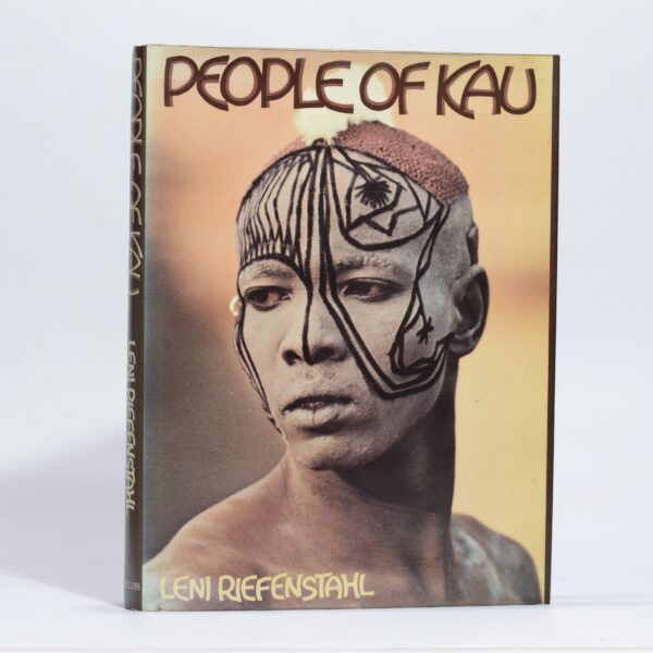
The People of Kau – Riefenstahl, Leni
A first English edition of Riefenstahl’s classic photographic essay. Previous owner’s bookplate to the fep. Condition:very good. Dust jacket: very good, hardcover Publisher: Collins Date Published: 1976 Publication Place: London First Edition: Yes Condition: very good Binding: hardcover Jacket Condition: very good Dimensions: 32 x 24.5cm
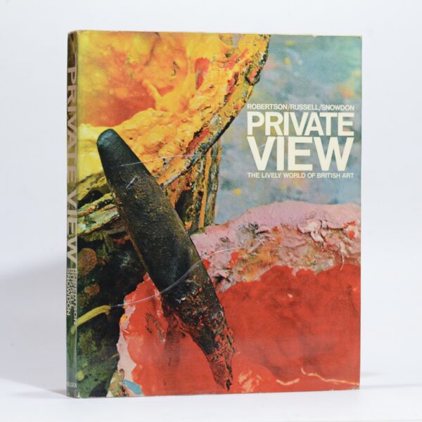
Private View. The Lively World of British Art – Robertson, Russell and Snowdon
A close up look at the London Art Scene in the 1960’s. Publisher: Thomas Nelson Date Published: 1965 Publication Place: London First Edition: Yes Condition: very good Jacket Condition: very good
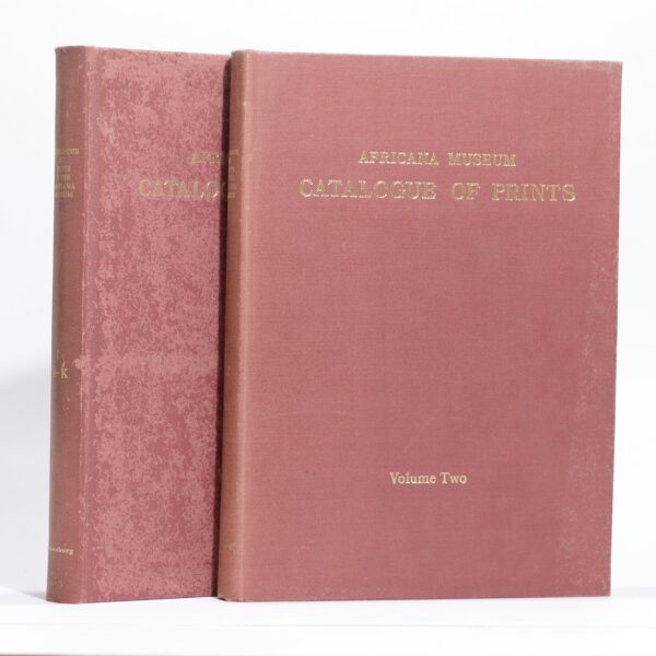
Catalogue of Prints in the Africana Museum – Kennedy, R.F.
and in books in the Strange Collection of Africana in the Johannesburg Public Library up to 1870. (2 volumes) Excellent, fully illustrated reference work in 2 volumes. Condition:very good.Some sunning and insect damage to the boards. Publisher: Africana Museum Date Published: 1975 Publication Place: Johannesburg First Edition: Yes Condition: Very good.Some sunning and insect damage…
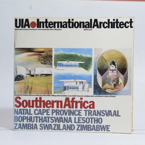
UIA. International Architect. Southern Africa. Issue 8 – Beck, Haig (ed.)
Issue 8 of this international architectural journal. Focussing on work in South Africa, Bophuthatswana, Lesotho, Zambia, Swaziland and Zimbabwe. Card wraps slightly curled. Condition: good Publisher: International Architect Date Published: 1985 Publication Place: London
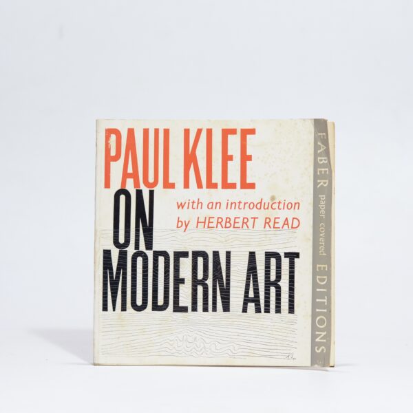
Paul Klee on Modern Art – Klee, Paul
With an introduction by Herbert Read. Klee’d short treatise on modern art accompanied by his drawings. Condition:good, some pages losening, softcover Publisher: Faber and Faber Date Published: 1966 Publication Place: London Condition: good Binding: softcover
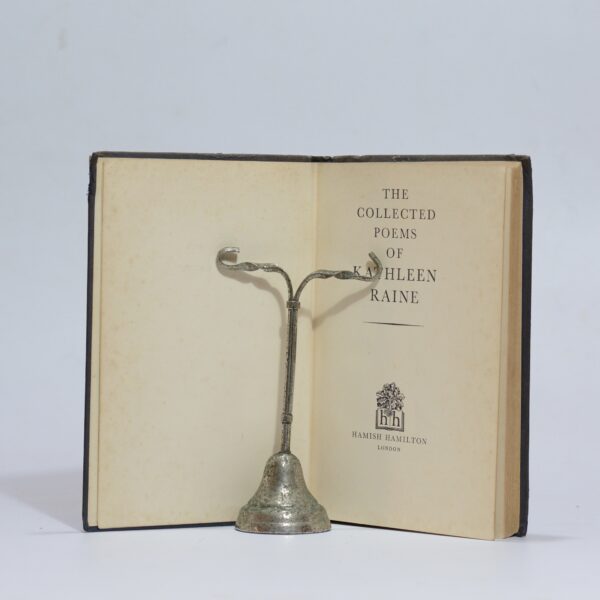
The Collected Poems of Kathleen Raine – Raine, Kathleen
First edition, first impression. Blue paper covered boards with some wear and staining. Sunning to the spine. Previous owner’s names to the fep. Publisher: Hamish Hamilton Date Published: 1956 Publication Place: London First Edition: Yes Condition: good
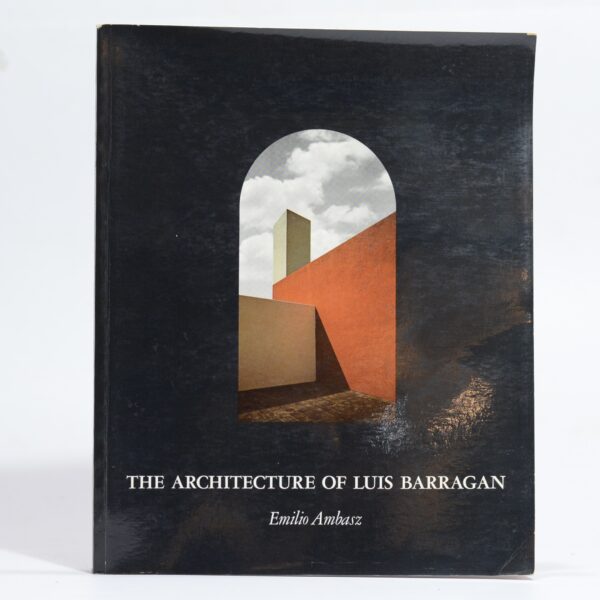
The Architecture of Luis Barragan – Ambasz, Emilio
THe first book to be produced on this Mexican bornlarchitect. Photographic reference to 7 of Barragan’s most accomplished projects followed by a Lost of Works at the end of the book. 128 pp. Third printing. Condition: very good, some light edge wear to the wraps. softcover Publisher: The Museum of Modern Art Date Published: 1982…
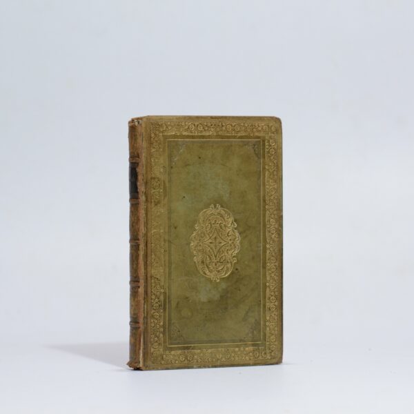
The Poetical Works of John Milton, Complete in one volume – Milton, John
Bound together with the works of Goldsmith, Cowper, Gray and Beattie. Full paneled green calf with marble end papers. Finely printed text in two columns. Some light wear. Publisher: Jones & Company Date Published: 1824 Publication Place: London Condition: good Dimensions: 11.5 x 18cm
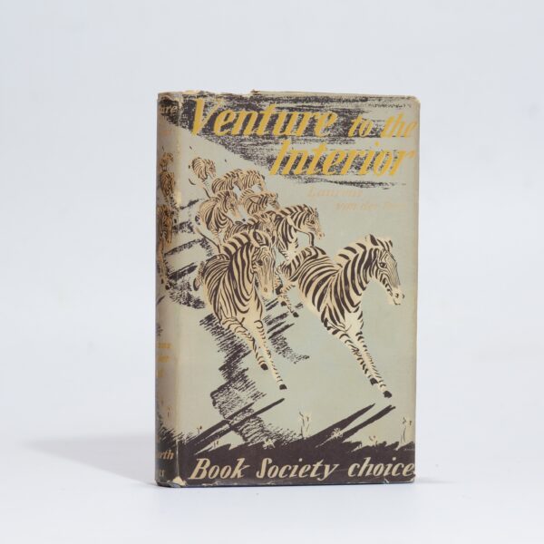
Venture to the Interior – van der Post, Laurens
A classic travel memoir detailing the author’s British government-commissioned mapping expedition to Nyasaland (now Malawi). The narrative chronicles his physical survey of the remote Mlanje mountain and Nyika Plateau alongside his deep psychological reflections. 5th impression. Condition: very good. Dust jacket: very good. Publisher: The Hogarth Press Date Published: 1952 Publication Place: London Condition: very…
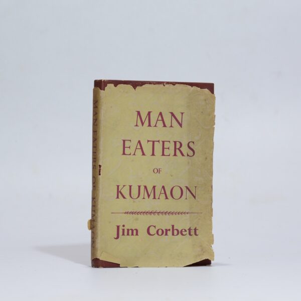
Man Eaters of Kumaon – Corbett, Jim
The author’s exploits with man-eating tigers in India. Condition: good. Dust jacket: poor Publisher: Readers Union Date Published: 1947 Publication Place: London Condition: good Has Dust Jacket: Yes Jacket Condition: poor
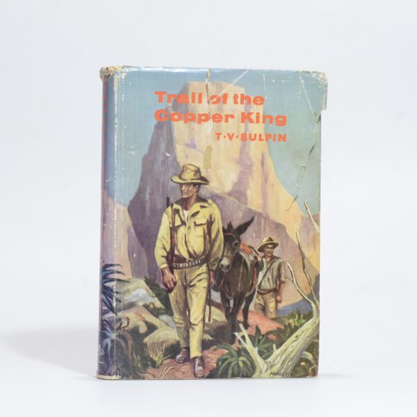
Trail of the Copper King – Bulpin, T. V.
Story of Orlando Baragwanath and the colourful company of prospectors who changed the destiny of Southern Africa in his quest to find the Copper Belt of Northern Rhodesia. Map as end papers. 239 Pages. Inscribed by the author to aunt Lou on the half title. 1st Edition. Condition: Good. Dust jacket: Fair-. Edge-wear and some…
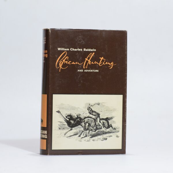
African Hunting – Blaldwin, William Charles
and Adventure from Natal to the Zambesi including Lake Ngami, The Kalahari Desert &c. from 1852 to 1860. Volume 4 of the African Hunting Reprint Series. A facsimile reprint of the 1863 edition with a new introduction by Gary W. Clendennen. Facsimile reprint. Condition: very good. Dust jacket: very good Publisher: Books of Zimbabwe Date…
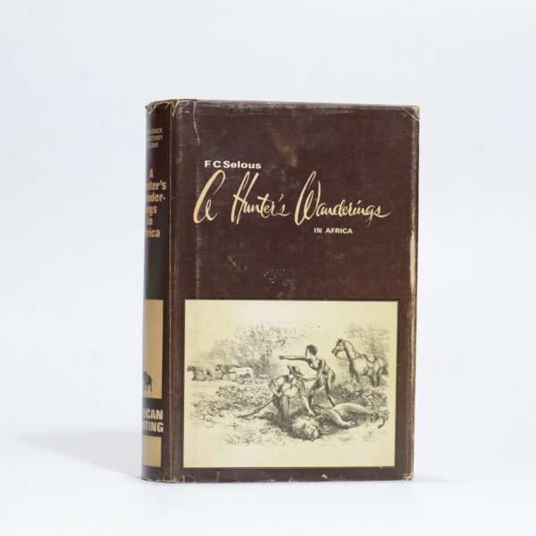
A Hunter’s Wanderings in Africa. – Selous, Frederick Courteney
Being a narrative of nine years spent amongst the game of the far interior of South Africa. Volume 5 of the African Hunting Reprint Series. A facsimile reprint of the 1881 edition with a new frontispiece and infroduction by Professor James A. Casada. Accounts of explorations beyond the Zambesi on the river Chobe, and in…
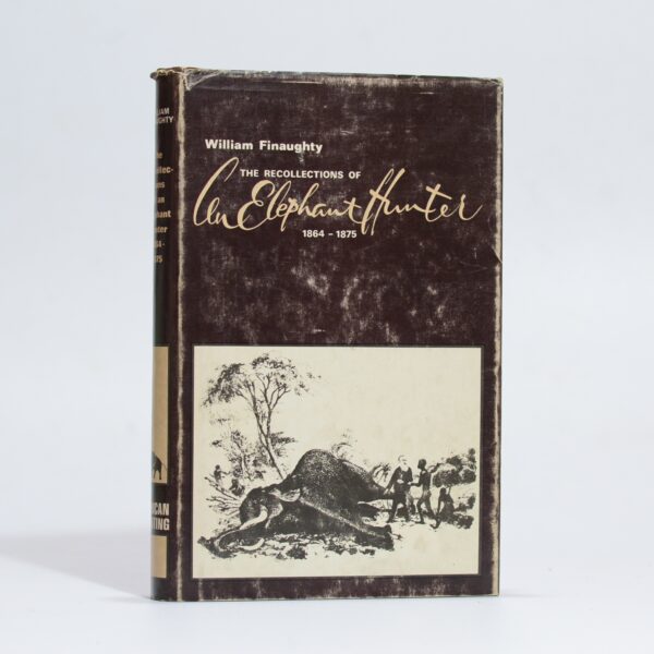
The Recollections of William Finaughty. Elephant Hunter 1864-1875 – Finaughty, William
A reprint of the 1916 edition with additional sketch map, illustrations, and a new foreward and notes by Edward C. Tabler. Volume 3 of the African Hunting Reprint Series. Facsimile reprint. Condition: very good. Dust jacket: good, some rubbing and edgewear, hardcover. Publisher: Books of Zimbabwe Date Published: 1980 Publication Place: Bulawayo Condition: very good…
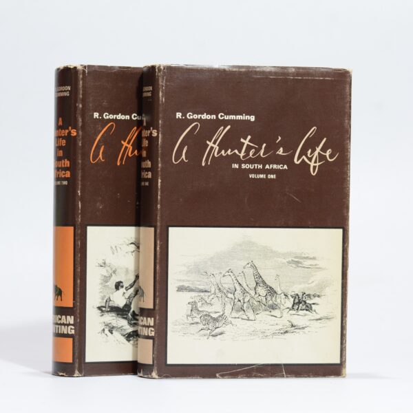
A Hunter’s Life in South Africa. (2 vols) – Gordon Cumming, R
Volume 1 and 2 of the African Hunting Reprint Series. A facsimile reproduction of the 1`850 edition with a new frontispiece and introduction by Professor James A. Casada. Previous owner’s name to the fep of both volumes. Facsimile reprint. Condiution: very good. Jacket condition: good, some light edgewear, hardcover. Publisher: Books of Zimbabwe Date Published:…
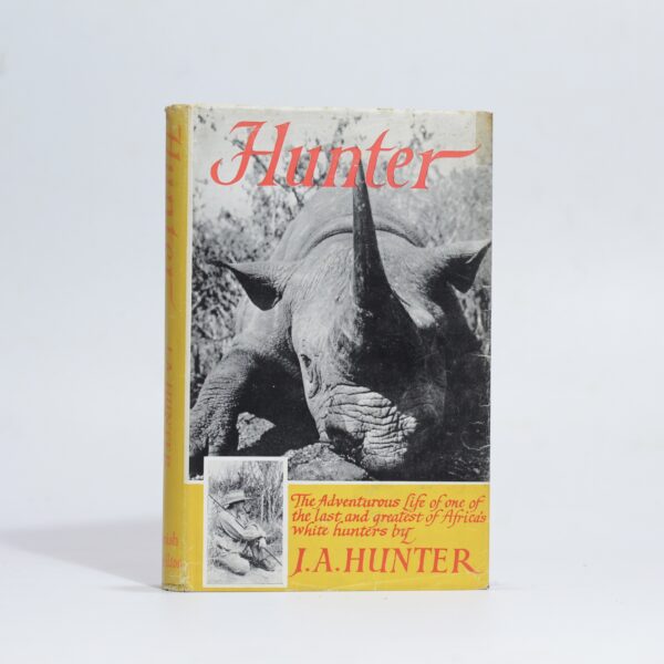
Hunter – Hunter, J.A.
“The adventurous life of one of the last and greatest of Africa’s white hunters…” Previous owner’s stamps to front and rear end papers. Third impression. Condition: good, a little foxing to the prelims. Jacket: good, edgewear, small piece of tape to the front foredge and a pervoration to back panel. hardcover Publisher: Hamish Hamilton Date…
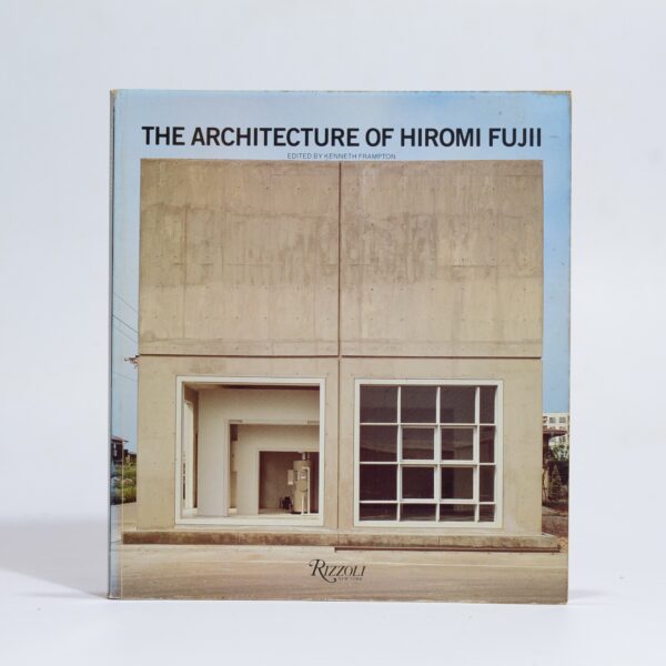
The Architecture of Hiromi Fujii – Frampton, Kenneth (ed), Fujii, Hiromi
Softcover, light wear, 127 pp. Publisher: Rizzoli Date Published: 1987 Publication Place: New York
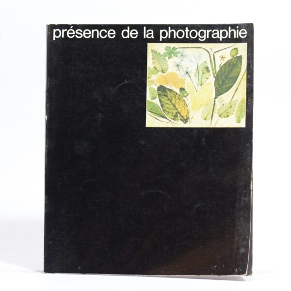
Presence de la photographie –
History of photography. 72 pp. many full colour photographs. Publisher: Kodak Date Published: 1969
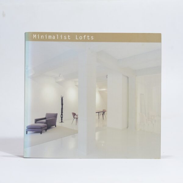
Minimalist Lofts – Cuito, Aurora
Illustrated though out with colour photographs. 215 pp. Publisher: Loft Publications Date Published: 2002 Publication Place: Spain Condition: Very good Binding: softcover Dimensions: 26 x 24cm
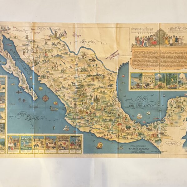
Mapa Illustrado de la Republica Mexicana. Pictorial Map of Mexico – Rare Large Format Edition – Gomez Medina, Miguel
Designed and drawn by Miguel Gomez Medina, a proponent of the Golden Age of Pictorial Mapmaking, active in the first half of the 20th century. Text in Spanish and English. Decorative vignettes illustrating highlights of Mexico’s history, culture and attractions. Condition: good. Some age toning, folds, pinholes to corners and small repaired chips to left…
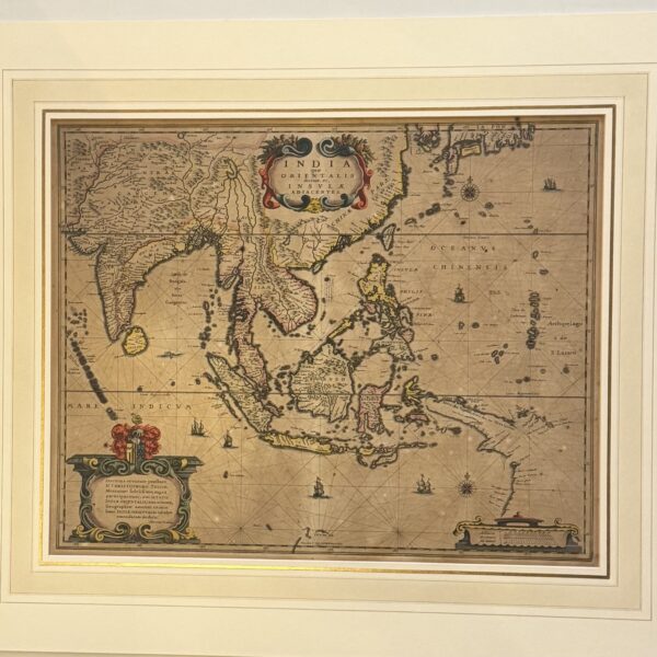
India que Orientalis dicitur, et Insulae Adiacentes – Hondius, H
Hondius map with early hand colouring. Notable for its depiction of the coastline of New Guinea, which appears attached to the coast of Australia. Latin text to the verso. Some browning to the sheet, a small repair to the lower right, visible from the verso only. A little britleness with some cracking at the platemark….
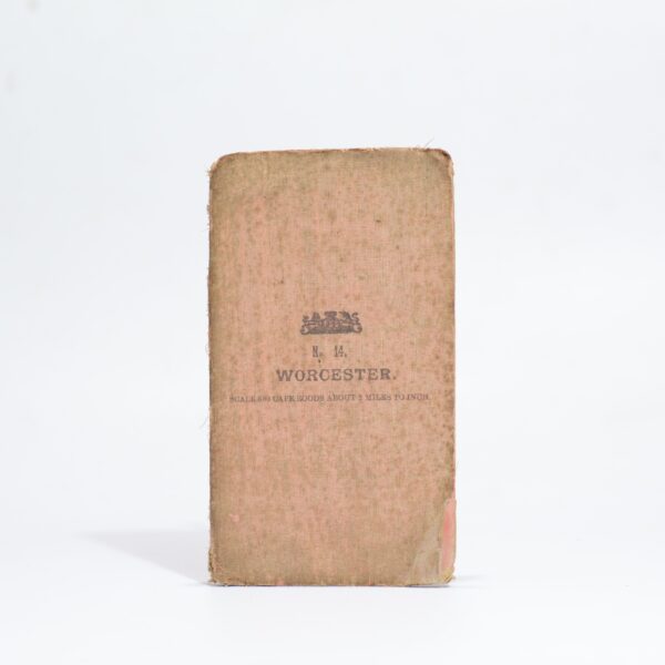
Map – Worcester and Surrounding Districts. Western Cape. South Africa –
Likely from a series of maps compiled by Major H.M. Jackson of the Field Intelligence Department during the Anglo-Boer War. A highly detailed topographical map with Rawsonville to the South marjn and Tulbagh and the Winter Hoek Mountains to the north. Indicates town, villages, rivers, mountains, railways, passes, roads and tracks. Condition: good. Some foxing…
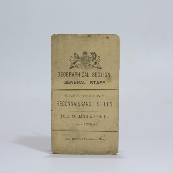
Cape Colony Reconnaissance Series. Port Nolloth & O’Okiep. Sheet: 127-K & L –
A detailed map of the area at a scale of 1:250 000 showing the course of the Orange River in the area between Prieska & Hopetown. A key noting towns, villages with locations, boundaries, railways, roads frequented by wagons, unfrequented, bridle paths, and steep or heavy requiring extra spans. Farm beacons and numbers, kraals and…
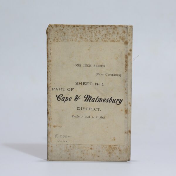
Map of the Malmesbury District. Sheet 1 of the One Inch Series. – Casgrain, Capt.
Surveyed by the Royal Engineers under the supervision of Captain Casgrain. Linen backed folding map. A detailed topographical map from the Anglo-Boer War period. Indicated are main roads and tracks, veld types, homesteads, towns and villages. From Melkbosch Strand to Ganze Kraal on the coast and Blaauwberg to Mamre inland. Condition: good. Some wear to…
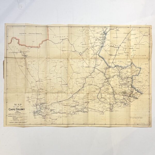
Map of the Cape Colony – Folding Map – Casgrain, Capt. R.H Du R
Linen backed folding map of the Colony compiled during the Anglo-Boer War. 25 miles to 1 inch, Showing districts, towns, villages, railway stations, sidings and telegraph offices. 76 x 54cm. Condition: good. Some foxing to the verso. Front wrap is missing. Date Published: 1901 Dimensions: 76 x 54cm
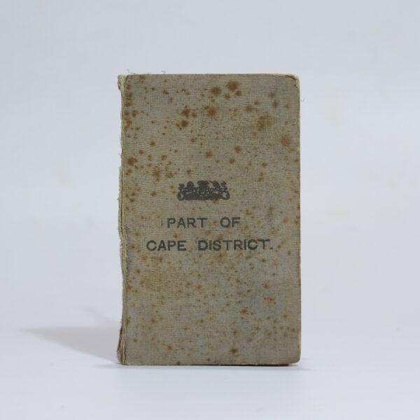
Map of Part of the Cape District –
Linen backed folding map with cloth bound wraps. A detailed map of the South Western Cape from Cape Town to Melkbos Strand. Indicating towns, railways, rivers, veld types, roads, blockhouses, farms, hotels, cemeteries, slaughterhouses, mission stations, asylums and more. Condition: good. Some light foxing at the folds Publisher: W.A. Richards and Sons Date Published: 1901…