Maps, Artifacts, Prints
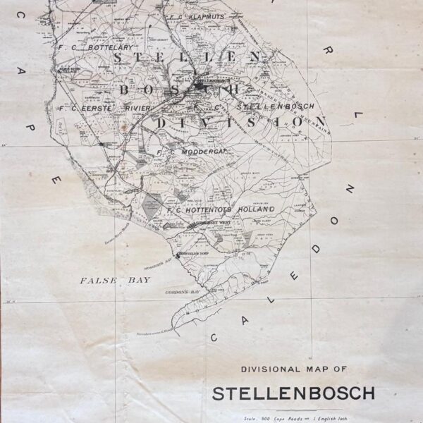
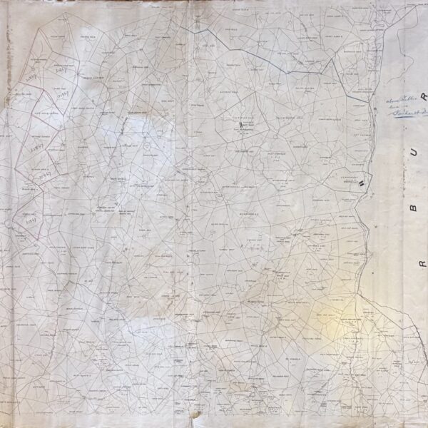
Divisional Map of Stellenbosch –
From Hoopen Berg in the North to Steenbras River Mouth. Shows farms: Meerlust, Zandvliet, Spier, Nooitgedacht, Zorgvliet, Blaauklippen and many more. Towns and villages – Stellenbosch, Kuilsriver, Somerset West, Ryneveld’s Dorp (The Strand), Fish Hoek (Gordon’s Bay). Size: 42 x 55cm. First Edition. Condition: Good. Publisher: Surveyor’s Office Date Published: 1890 Publication Place: Cape Town…
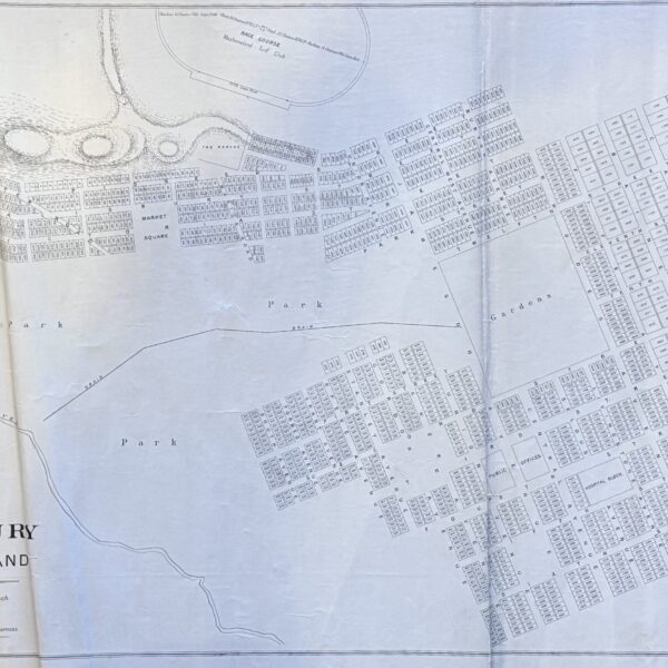
Plan of Salisbury, Mashonaland – Ross, Thomas
The first plan of Salisbury. The town grid was laid out by the American surveyor, Thomas Ross in 1891. He was the nephew of the Mashonaland Administrator, Archibald Colqhoun. Original early copies such as this one are exceedingly scarce. Linen-backed. Size 88 x 57cm. First Edition. Condition: Very good. Some creasing that will flatten with…
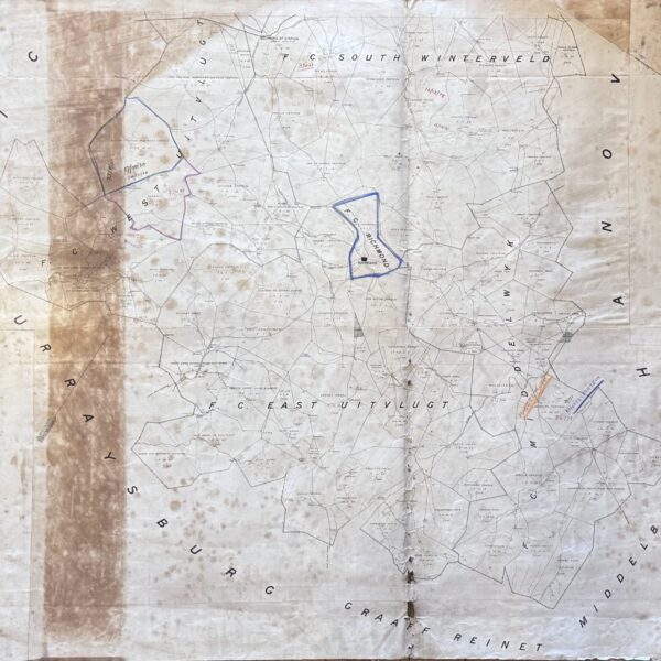
Divisional Map Richmond – bound by the districts of Graaff Reinet, Middelburg, Murraysburg, Hanover –
Shows Richmond with boundaries of surrounding farms. Roads, tracks, outspans and rivers. Linen-backed. First Edition. Condition: Fair. Age-toning, foxing, folds, some holes – 2cm across to a few smaller ones. Publisher: Surveyor’s Office Date Published: Circa 1890 Publication Place: Cape Town First Edition: Yes Condition: Fair. Age-toning, foxing, folds, some holes – 2cm across to…
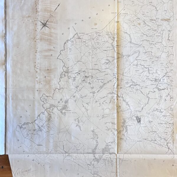
Divisional Map of Xalanga District –
Divisional map of Xalanga district bounded by the Indwe river to the west with the Tsomo river and the village of Cala to the east. Indicates villages and settlements, trading stations, police posts, churches, outspans and rivers. Linen-backed. Dize 88 x 110cm. First Edition. Good. With some folds and age-toning and foxing. Left bottom corner…
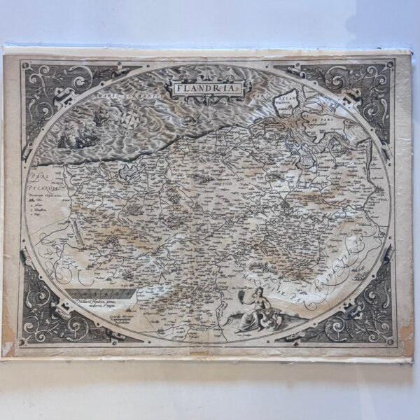
Flandria – Ortelius, Abraham
A rare example of the first state (1570) of this seminal map of Flanders from the historic first printing (Map 1570) of Ortelius’ Theatrum Orbis Terrarum, universally recognised as the world’s first true modern atlas and the most expenive book published to date. Latin to the verso with Pg 17 and last line of text…
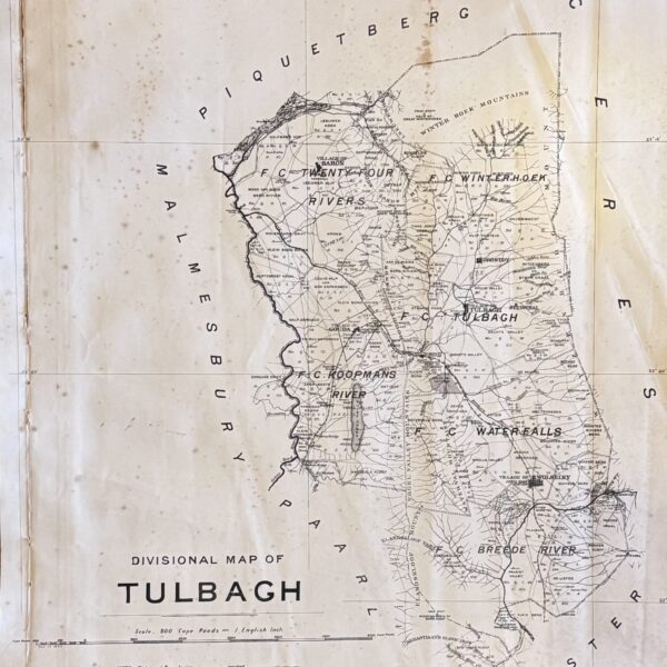
Divisional Map – Tulbagh. From the Winterhoek Mountains to Mosterts Hoerk –
Divisional map of the Tulbagh District as it was in 1890. Amongst others the villages of Tulbagh, Saron, Gouda and Wolsley are shown. Railways, rivers, commonages, outspans and bridges are indicated. Linen backed. Size: 46 x 57 cm. Condition: Good. Some age-toning and folds. Publisher: The South African Association Date Published: 1890 Condition: Good. Some…
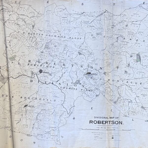
Divisional Map – Robertson, Montagu, Lady Grey (McGregor) –
Divisional map of the Robertson area. Showing farm boundaries, towns and villages, outspans and rivers. McGregor is still noted by its old name “Lady Grey”. Linen backed. Size: 57 x 88 cm. Condition: Good with some age-toning and folds. Publisher: The South African Association Date Published: Circe 1890 First Edition: Yes Condition: Good.
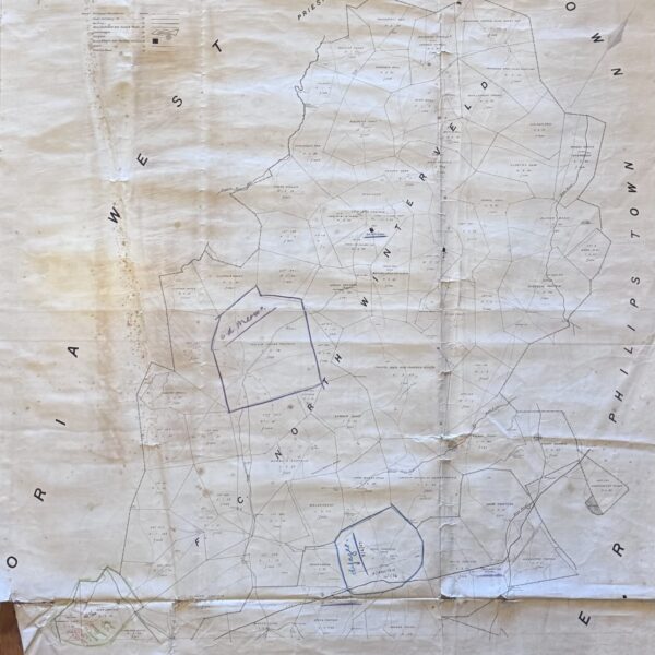
Divisional Map Richmond – [Neuman, Thomas C. (comp.), Templer Horne, J (Surveyor-General)]
District of Victoria West to the west, Philip’s Town district to the east, and Hope Town district to the north. Boundaries of farms are shown, as well as railway lines, roads and tracks, outspans, rivers and other landmarks. This is an individual Divisional Sheet that would have been used as reference for the 1895 Surveyor-General’s…
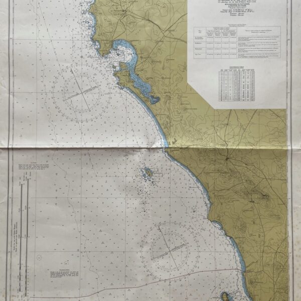
Chart of Cape Columbine to Table Bay –
With insets of anchorages at Hout Bay, Dassen Island, and Murray’s Bay Harbour, Robben Island. October 1960 with small corrections up to 1968. Some folds and age-toning. Condition: Good. Publisher: South Africa Hydrographic Office Date Published: 1968 Publication Place: Cape Town Condition: Good. Dimensions: 70cmx104cm
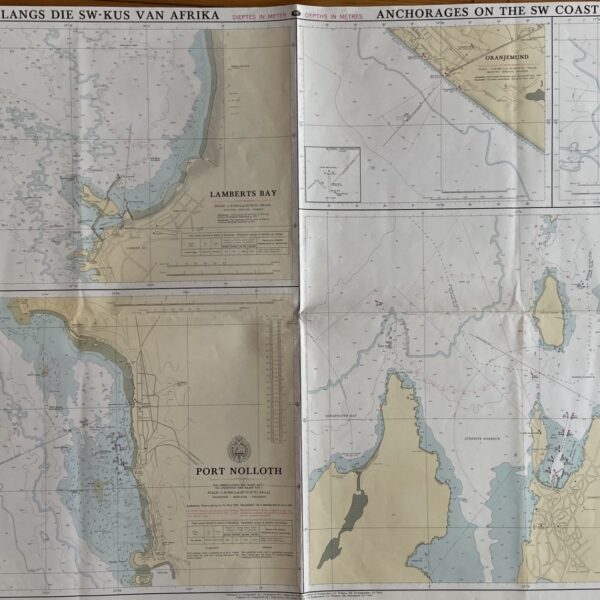
Anchorages on the South West Coast of Africa –
With insets of Lamberts Bay, Port Nolloth, Hondeklipbaai, Oranjemund, and Luderitz. Some folds with slight age-toning. Condition: Good Publisher: South African Navy Date Published: 1971 Publication Place: Cape Town Condition: Good. Dimensions: 70cmx101cm
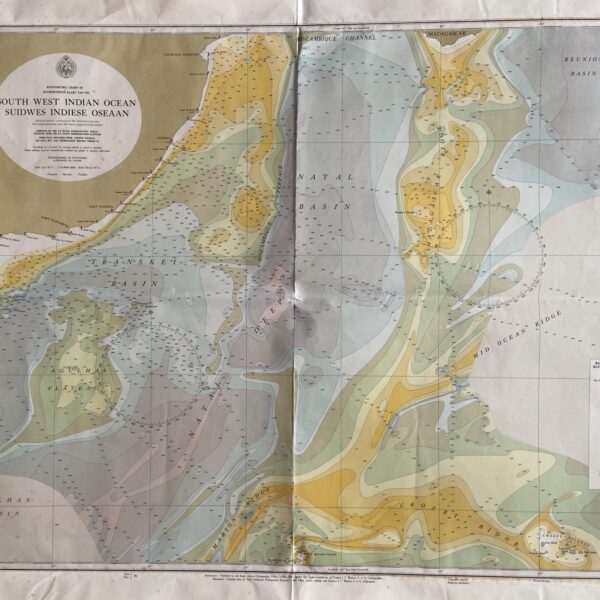
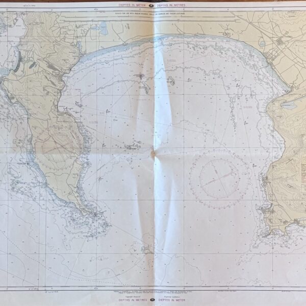
Chart of South West Indian Ocean. –
Cape Agulhas to Lourenco Marques Some folds and age-toning. Condition: Good. Publisher: South African Hydrographic Office Date Published: 1964 Publication Place: Simonstown Condition: Good. Dimensions: 82cmx99cm
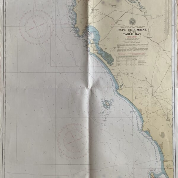
Chart. Cape Columbine to Table Bay. –
From St. Helena Bay to Table Bay From surveys of the South African Navy up to 1970. Scale: 1:150 000. Insets of Huisbaai, Dasseneiland. Publisher: South African Navy Date Published: 1971 Publication Place: Cape Town
False Bay –
Some folds and age-toning. Condition: Good. Publisher: S.A Navy Date Published: 1970 Publication Place: Cape Town Condition: Good. Dimensions: 100cmx71cm
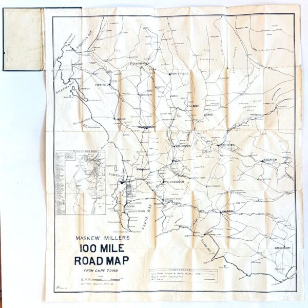
Maskew Miller’s 100 Mile Road Map from Cape Town – Masker Miller, T
Showing the Southern Cape coast from St. Helena Bay to Cape Agulhas. Key showing: Hard roads suitable for Motor Traffic, Roads under construction and Railways. With an inset showing the main roads of the Peninsula. Linen backed folding map with some wear to the creases but generally very good condition. Second edition. Condition: Very good….
District Map Calvinia – [Neuman, Thomas C. (comp.), Templer Horne, J (Surveyor-General)]
Namakwa district of the Northern Cape. Shows the village of Brandvlei and, to the northwest, the Katkop village assosciated with Ixam (San) history as collected by Bleek and Lloyd. Indicates boundaries, commonages, and outspans. This is an individual Divisional Sheet that would have been used as reference for the 1895 Surveyor-General’s major map of the…
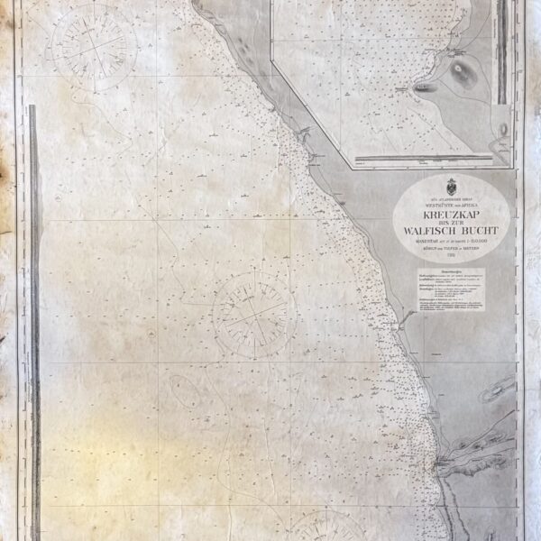
Chart Cape Cross to Walfisch Bay –
Text: German. Detailed chart of part of Namibia, engraved at the time it was still a German colony. 1911, revised 1914 and 1927. Detailed inset of area surrounding Cape Cross. Margins worn with small chips. Age-toning and wear. Condition: Good. Publisher: Reichs-Marine Date Published: 1927 Publication Place: Berlin Condition: Good. Dimensions: 69cm x 105cm

District Map Riversdale – [Neuman, Thomas C. (comp.), Templer Horne, J (Surveyor-General)]
Boundaries of farms in the district are shown. Roads, tracks, outspans, villages, and rivers are indicated. The villages of Riversdale, Heidelberg, the Duivenshok. Kafferkuils and Gouritz rivers, Vermaaklikheid, Kleinefontein, Morris Point, Cape Barracouta, are some of the landmarks indicated. This is an individual Divisional Sheet that would have been used as reference for the 1895…
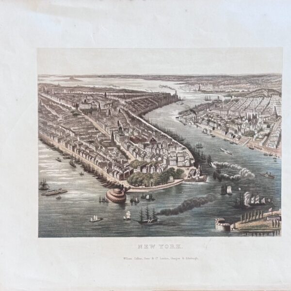
New York –
Chromo-lithograph. Prior to building of bridges. Some creases. Condition: Good to very good. Publisher: Collins and Sons Date Published: 1878 Publication Place: Glasgow Condition: Good. Dimensions: 27cmx33.5cm sheet size
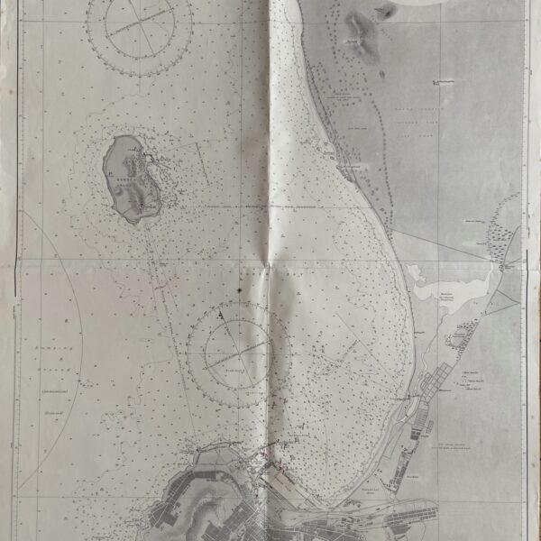
Chart of Table Bay. –
Surveyed by Liet. Commander J. Dalgleish South African Surveying Ship “Africana” Published August 1936, with additions and corrections May 1966. Some folds and age-toning. Condition: Good. Publisher: Admirality Date Published: 1966 Condition: Good. Dimensions: 70cmx103cm
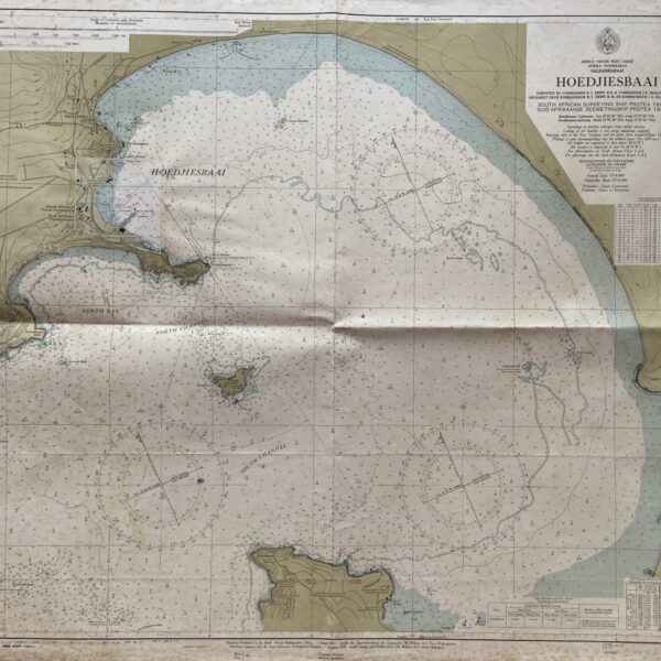
Chart of Hoedjiesbaai –
Surveyed by Commander S. Tripp and Commander J.K Mallory S.A.N on the South African surveying ship Protea 1954-1955. With corrections up to 1968. Folds and age-toning. Condition: Good. Publisher: South African Hydrographic Office Date Published: 1968 Condition: Good. Dimensions: 86cmx71cm
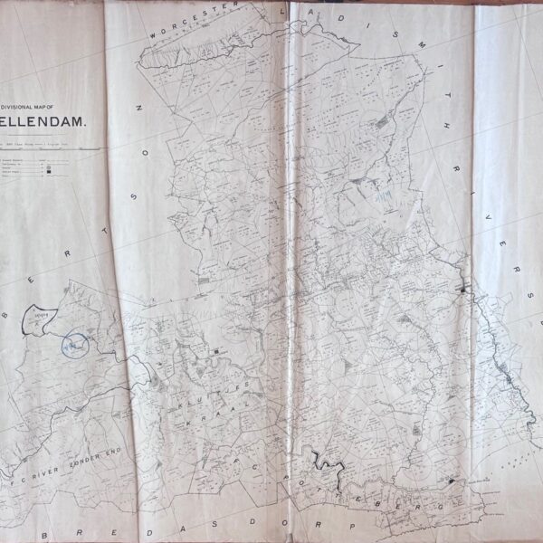
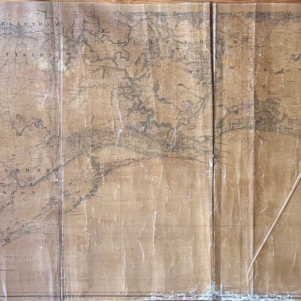
Divisional Map of Swellendam District – [Neuman, Thomas C. (comp.), Templer Horne, J (Surveyor-General)]
A divisional map of the Swellendam District. Including the village of Swellendam. The Breede river mouth (Port Beaufort) to the south east, Heidelberg and the Touws river to the north. Also included are Cape Infanta, the Duivenhoks river mouth and Barrydale (Tradow’s Hoek). A key to Divisional Boundaries, Field Cornetcy Boundaries, Outspans, Towns and Villages…
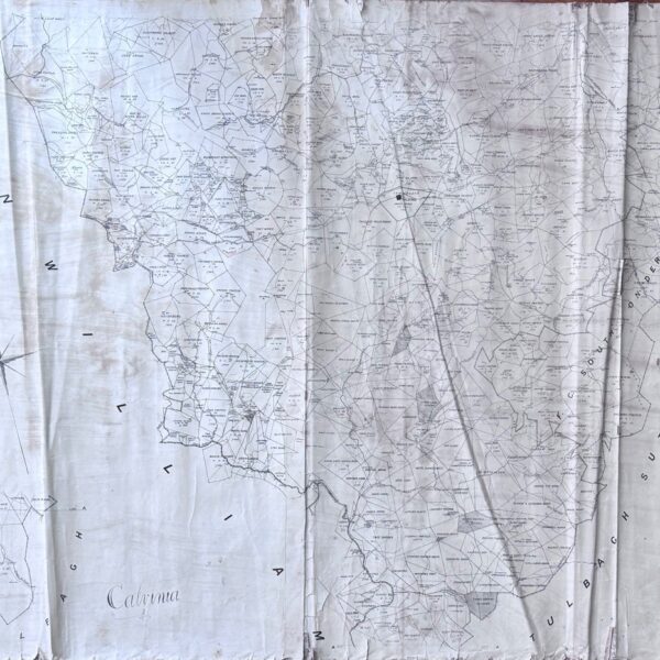
Divisional Map of Swellendam, Bredasdorp and Riversdal Districts and coastal area from Agulhas to Still Bay. – [Neuman, Thomas C. (comp.), Templer Horne, J (Surveyor-General)]
Farm boundaries, names and numbers are shown. Along with rivers, topographical and other interesting information. The village of Swellendam is shown to the north. The Bredasdorp and Riversdal Divisions are also shown. This is an individual Divisional Sheet that would have been used as reference for the 1895 Surveyor-General’s major map of the Colony of…
Divisional Map of the District of Calvinia – [Neuman, Thomas C. (comp.), Templer Horne, J (Surveyor-General)]
The village of Calvinia is central. Bounded by the divisions of Clanwilliam (boarded by the Doring river) to the west and Tulbagh Sutherland to the east. There is an inset titled Tulbagh, showing a few farm but not the village. This is an individual Divisional Sheet that would have been used as reference for the…
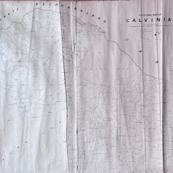
Divisional Map of the District of Calvinia – [Neuman, Thomas C. (comp.), Templer Horne, J (Surveyor-General)]
Showing the Orange river as the northern boundary. Onseep kans to the west with “German Protectorate” over the river. Also Bechuanaland and Carnarvon. Showing farm names, numbers and boundaries and Crown Land. Scale given at 1200 Cape roods to 1 English inch. This is an individual Divisional Sheet that would have been used as reference…
Wireless Map of the World. –
Featuring: stations opened to Public Service; Stations open to Ship and Shore Communication; High Power Public Service; Private Stations; High Power Private Stations; Imperial Scheme; Trans-Ocean Service; Lightships; Lighthouses. Page 208 to 246 of Lloyds calendar attached to the rear. Tears to a number of folds some of which have been re-inforced with old cellotape….
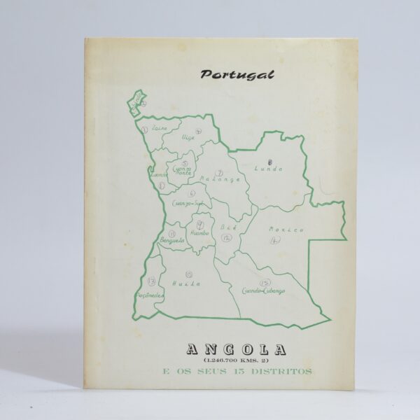
Angola. District Maps –
15 District maps. Numbers in ink on the front cover. Some handling marks to cardwraps. Condition: Good. Binding: Softcover. Thin cardwraps. Mild edge-wear. Publisher: Edicoes Spal Publication Place: Luanda Condition: Good Binding: Softcover. Thin cardwraps. Mild edge-wear.
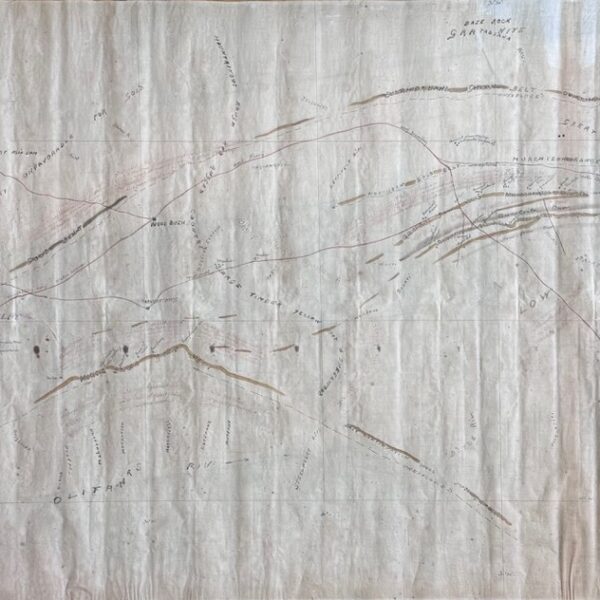
Map of the Goldfields showing Sutherland, Murchison, Roodepoort at Wood Bush Ranges – [Stahl, Jurgen]
An original field survey manuscript map drawn around 1880 showing many unexplored ranges. The area shown is boarded by Sutherland Gold Belt in the north; Portuguese Territory to the east; the Olifants River and Wood Bush Gold Belt in the south and Marabastad to the west. It is likely the work of either Friedrich Jeppe…
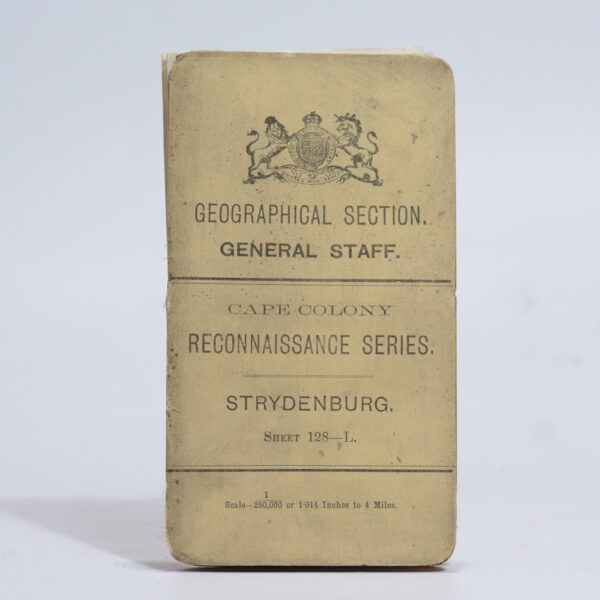
Cape Colony Reconnaissance Series. Strydenburg Sheet: 128-L –
A detailed map of the area at a scale of 1:250 000 showing the course of the Orange River in the area between Prieska & Hopetown. A key noting towns, villages with locations, boundaries, railways, roads frequented by wagons, unfrequented, bridle apaths, and steep or heavy requiring extra spans. Farm beacons and numbers, kraals and…
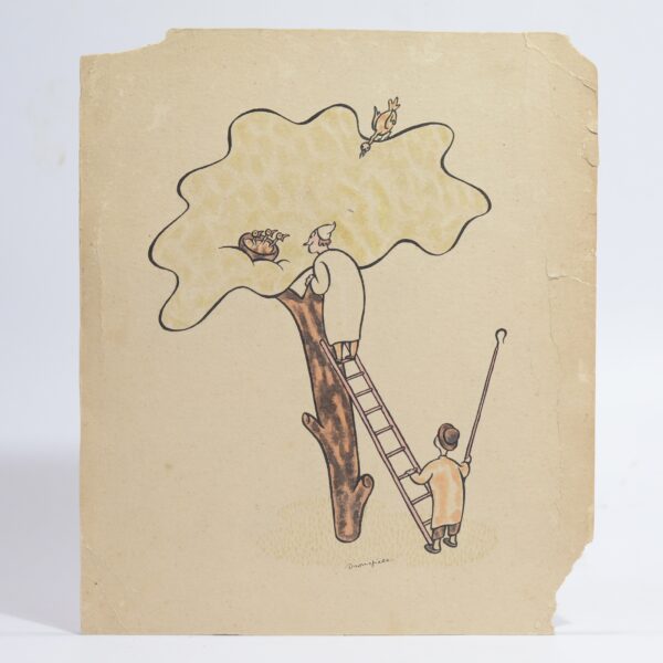
Ink and Watercolour on Card – Dronsfield, John
John Marsden Dronsfield (19001951) was an English-born graphic artist, painter, and stage designer who became a prominent figure in the South African art scene. Born in Lancashire, he was largely self-taught, having only briefly studied at the Manchester School of Art. Following his death by suicide in 1951, several memorial exhibitions were held in Cape…

Direcão dos Serviços de Obras Públicas E Transportes. Mapa Rodoviario. –
Provincia de Angola Folding map of Angola in four sections. Some pencil maginalia to the map. Tears to the cover does not affect the map sections. Previous owner name. Condition: Good. Binding: Softcover. 4cm tear across the spine and covers. Tears to the head and foot of spine. Some edge-wear to extremities. Map Publisher: Directorate…