Maps, Artifacts, Prints
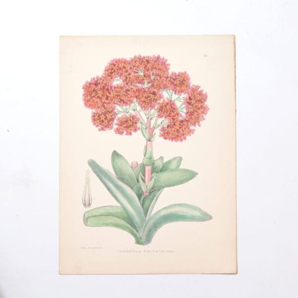
Hand Coloured Plate from The Flowering Plants of South Africa – Crassula Falcata –
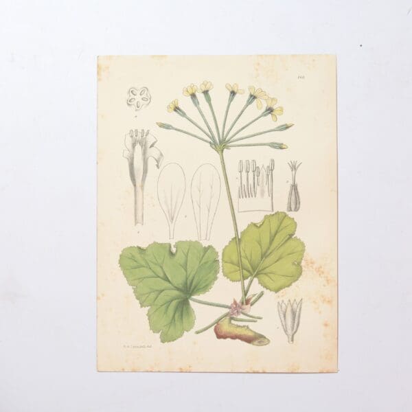
The first 27 volumes 1921 – 1948 had 1080 hand coloured plates. Subsequent volumes have colour lithographed plates. The series is still in publication and is currently on its 70th volume. Each hand coloured plate focuses on a different flowering plant species indigenous to South Africa accompanied by a description of their unique botanical characteristics,…
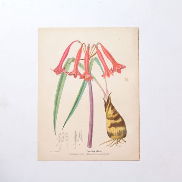
Hand Coloured Plate from The Flowering Plants of South Africa – Cyrtanthus Contractus –
The first 27 volumes 1921 – 1948 had 1080 hand coloured plates. Subsequent volumes have colour lithographed plates. The series is still in publication and is currently on its 70th volume. Each hand coloured plate focuses on a different flowering plant species indigenous to South Africa accompanied by a description of their unique botanical characteristics,…
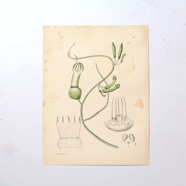
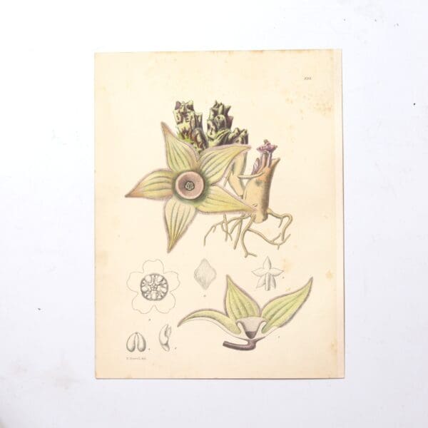
Hand Coloured Plate from The Flowering Plants of South Africa – Ceropegia Ampliata –
The first 27 volumes 1921 – 1948 had 1080 hand coloured plates. Subsequent volumes have colour lithographed plates. The series is still in publication and is currently on its 70th volume. Each hand coloured plate focuses on a different flowering plant species indigenous to South Africa accompanied by a description of their unique botanical characteristics,…
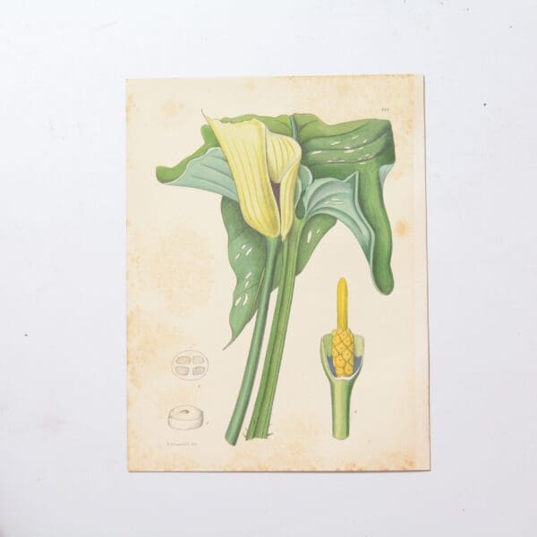
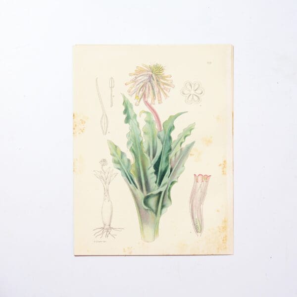
Hand Coloured Plate from The Flowering Plants of South Africa – Richardia Melanoleuca –
The first 27 volumes 1921 – 1948 had 1080 hand coloured plates. Subsequent volumes have colour lithographed plates. The series is still in publication and is currently on its 70th volume. Each hand coloured plate focuses on a different flowering plant species indigenous to South Africa accompanied by a description of their unique botanical characteristics,…
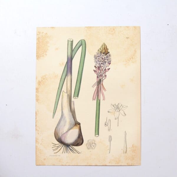
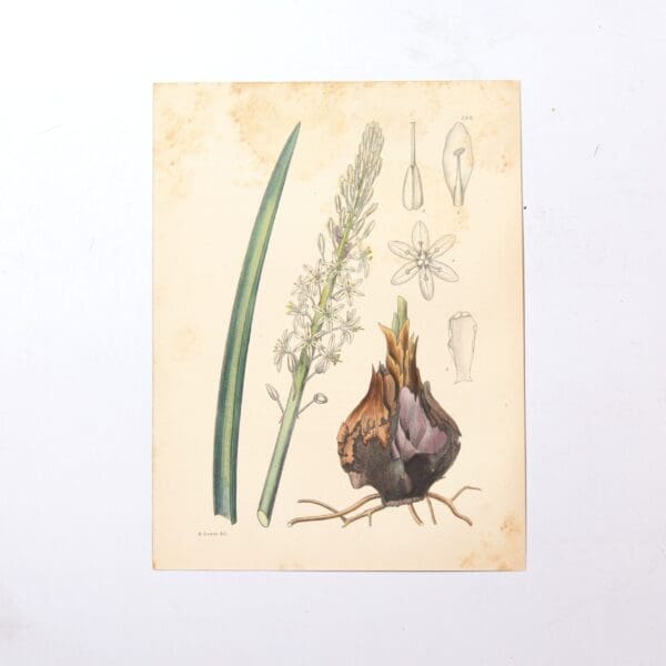
Hand Coloured Plate from The Flowering Plants of South Africa – Urginea Macrocentra –
The first 27 volumes 1921 – 1948 had 1080 hand coloured plates. Subsequent volumes have colour lithographed plates. The series is still in publication and is currently on its 70th volume. Each hand coloured plate focuses on a different flowering plant species indigenous to South Africa accompanied by a description of their unique botanical characteristics,…
Hand Coloured Plate from The Flowering Plants of South Africa – Ceropegia Sandersoni –
The first 27 volumes 1921 – 1948 had 1080 hand coloured plates. Subsequent volumes have colour lithographed plates. The series is still in publication and is currently on its 70th volume. Each hand coloured plate focuses on a different flowering plant species indigenous to South Africa accompanied by a description of their unique botanical characteristics,…
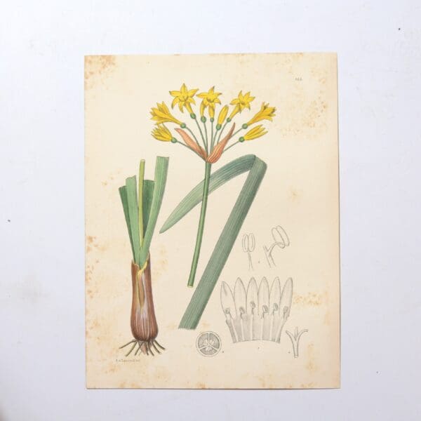
Hand Coloured Plate from The Flowering Plants of South Africa – Anoiganthus Breviflorus –
The first 27 volumes 1921 – 1948 had 1080 hand coloured plates. Subsequent volumes have colour lithographed plates. The series is still in publication and is currently on its 70th volume. Each hand coloured plate focuses on a different flowering plant species indigenous to South Africa accompanied by a description of their unique botanical characteristics,…
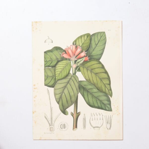
Hand Coloured Plate from The Flowering Plants of South Africa – Burchellia Bubalina –
The first 27 volumes 1921 – 1948 had 1080 hand coloured plates. Subsequent volumes have colour lithographed plates. The series is still in publication and is currently on its 70th volume. Each hand coloured plate focuses on a different flowering plant species indigenous to South Africa accompanied by a description of their unique botanical characteristics,…
Hand Coloured Plate from The Flowering Plants of South Africa – Pelarogonium Pulverulentum –
The first 27 volumes 1921 – 1948 had 1080 hand coloured plates. Subsequent volumes have colour lithographed plates. The series is still in publication and is currently on its 70th volume. Each hand coloured plate focuses on a different flowering plant species indigenous to South Africa accompanied by a description of their unique botanical characteristics,…
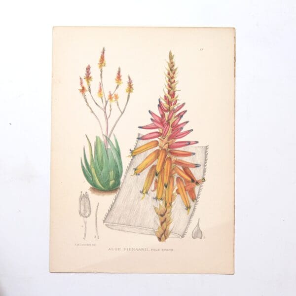
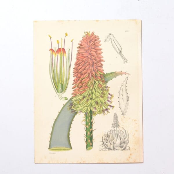
Hand Coloured Plate from The Flowering Plants of South Africa – Aloe Pienarii –
The first 27 volumes 1921 – 1948 had 1080 hand coloured plates. Subsequent volumes have colour lithographed plates. The series is still in publication and is currently on its 70th volume. Each hand coloured plate focuses on a different flowering plant species indigenous to South Africa accompanied by a description of their unique botanical characteristics,…
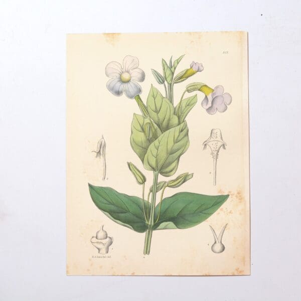
Hand Coloured Plate from The Flowering Plants of South Africa – Thunbergia Natalensis –
The first 27 volumes 1921 – 1948 had 1080 hand coloured plates. Subsequent volumes have colour lithographed plates. The series is still in publication and is currently on its 70th volume. Each hand coloured plate focuses on a different flowering plant species indigenous to South Africa accompanied by a description of their unique botanical characteristics,…
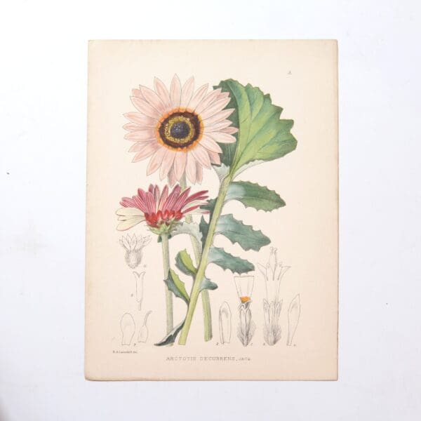
Hand Coloured Plate from The Flowering Plants of South Africa – Arcotis Fosteri –
The first 27 volumes 1921 – 1948 had 1080 hand coloured plates. Subsequent volumes have colour lithographed plates. The series is still in publication and is currently on its 70th volume. Each hand coloured plate focuses on a different flowering plant species indigenous to South Africa accompanied by a description of their unique botanical characteristics,…
Hand Coloured Plate from The Flowering Plants of South Africa – Aloe Peglerae –
The first 27 volumes 1921 – 1948 had 1080 hand coloured plates. Subsequent volumes have colour lithographed plates. The series is still in publication and is currently on its 70th volume. Each hand coloured plate focuses on a different flowering plant species indigenous to South Africa accompanied by a description of their unique botanical characteristics,…
Hand Coloured Plate from The Flowering Plants of South Africa – Pseudobaeckea Vigata –
The first 27 volumes 1921 – 1948 had 1080 hand coloured plates. Subsequent volumes have colour lithographed plates. The series is still in publication and is currently on its 70th volume. Each hand coloured plate focuses on a different flowering plant species indigenous to South Africa accompanied by a description of their unique botanical characteristics,…
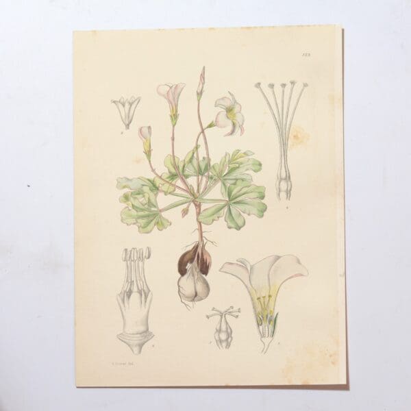
Hand Coloured Plate from The Flowering Plants of South Africa – Oxalis Lupinifolius –
The first 27 volumes 1921 – 1948 had 1080 hand coloured plates. Subsequent volumes have colour lithographed plates. The series is still in publication and is currently on its 70th volume. Each hand coloured plate focuses on a different flowering plant species indigenous to South Africa accompanied by a description of their unique botanical characteristics,…
Hand Coloured Plate from The Flowering Plants of South Africa – Cotyledon Wickensii –
The first 27 volumes 1921 – 1948 had 1080 hand coloured plates. Subsequent volumes have colour lithographed plates. The series is still in publication and is currently on its 70th volume. Each hand coloured plate focuses on a different flowering plant species indigenous to South Africa accompanied by a description of their unique botanical characteristics,…
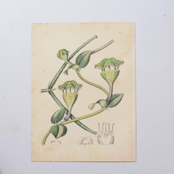
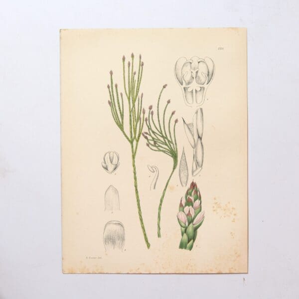
Hand Coloured Plate from The Flowering Plants of South Africa – Diplocyatha Ciliata –
The first 27 volumes 1921 – 1948 had 1080 hand coloured plates. Subsequent volumes have colour lithographed plates. The series is still in publication and is currently on its 70th volume. Each hand coloured plate focuses on a different flowering plant species indigenous to South Africa accompanied by a description of their unique botanical characteristics,…
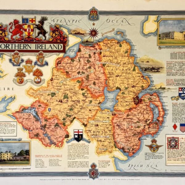
Northern Island, county map. – Clegg, Ernest
This pictorial map is part of “The Countryman County Maps of Britain” series. Designed and drawn by Ernest Clegg. The maps were commissioned to raise money for the Women’s Land Army Benevolent Fund, providing financial support for the many women volunteers who had contributed to boosting and sustaining food production during the war. Promoted by…
Hand Coloured Plate from The Flowering Plants of South Africa – Urginia Burkei –
The first 27 volumes 1921 – 1948 had 1080 hand coloured plates. Subsequent volumes have colour lithographed plates. The series is still in publication and is currently on its 70th volume. Each hand coloured plate focuses on a different flowering plant species indigenous to South Africa accompanied by a description of their unique botanical characteristics,…
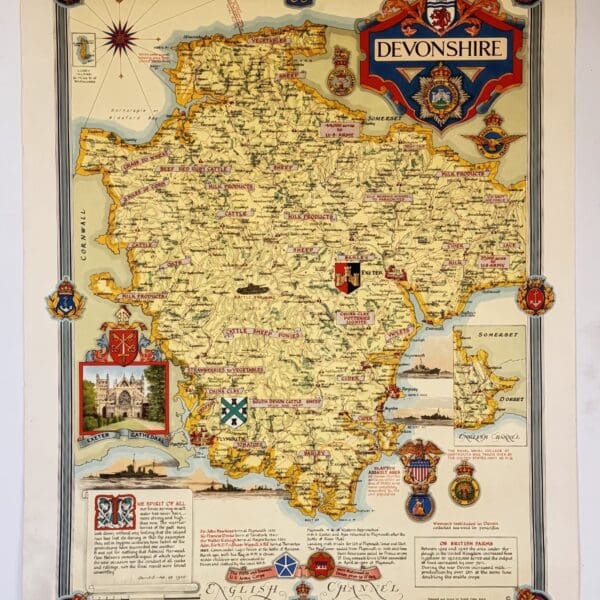
Devonshire, county map. – Clegg, Ernest
This pictorial map is part of “The Countryman County Maps of Britain” series. Designed and drawn by Ernest Clegg. The maps were commissioned to raise money for the Women’s Land Army Benevolent Fund, providing financial support for the many women volunteers who had contributed to boosting and sustaining food production during the war. Promoted by…
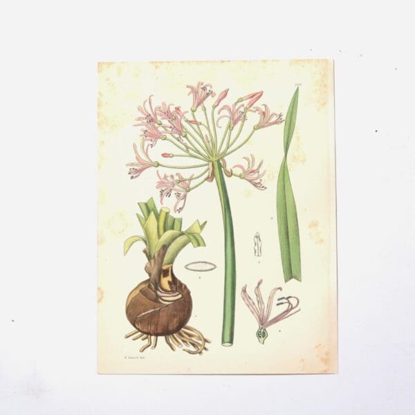
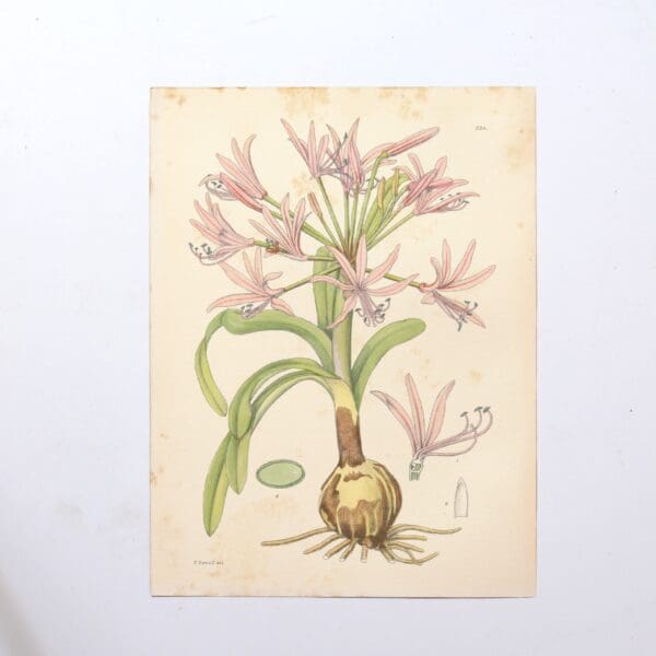
Hand Coloured Plate from The Flowering Plants of South Africa – Nerine Flexuosa –
The first 27 volumes 1921 – 1948 had 1080 hand coloured plates. Subsequent volumes have colour lithographed plates. The series is still in publication and is currently on its 70th volume. Each hand coloured plate focuses on a different flowering plant species indigenous to South Africa accompanied by a description of their unique botanical characteristics,…
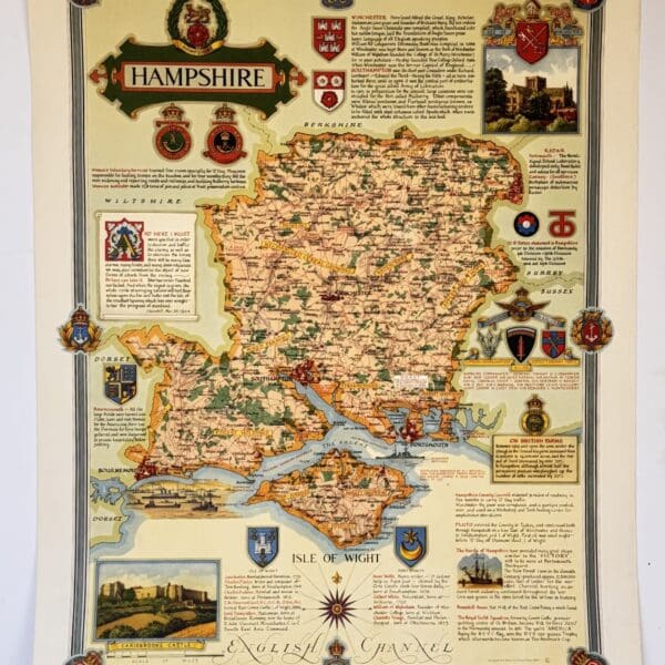
Hampshire, county map. – Clegg, Ernest
This pictorial map is part of “The Countryman County Maps of Britain” series. Designed and drawn by Ernest Clegg. The maps were commissioned to raise money for the Women’s Land Army Benevolent Fund, providing financial support for the many women volunteers who had contributed to boosting and sustaining food production during the war. Promoted by…
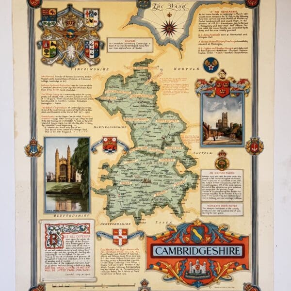
Cambridgeshire, county map. – Clegg, Ernest
This pictorial map is part of “The Countryman County Maps of Britain” series. Designed and drawn by Ernest Clegg. The maps were commissioned to raise money for the Women’s Land Army Benevolent Fund, providing financial support for the many women volunteers who had contributed to boosting and sustaining food production during the war. Promoted by…
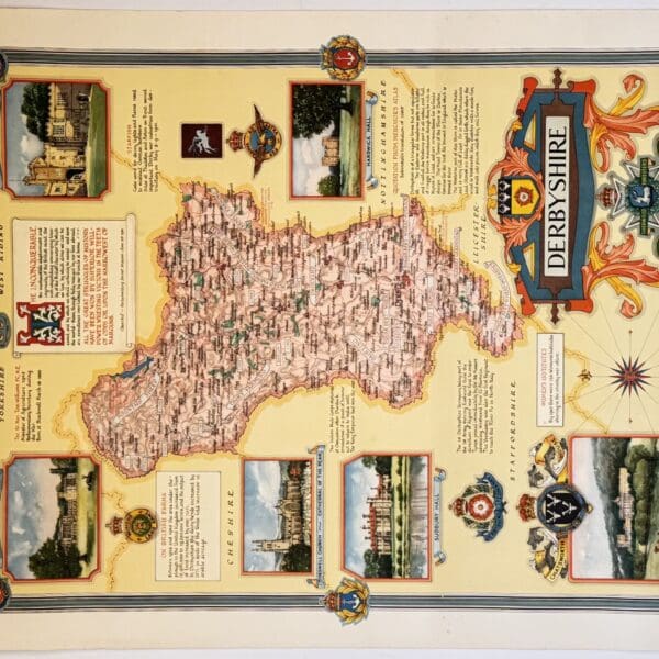
Derbyshire, county map. – Clegg, Ernest
This pictorial map is part of “The Countryman County Maps of Britain” series. Designed and drawn by Ernest Clegg. The maps were commissioned to raise money for the Women’s Land Army Benevolent Fund, providing financial support for the many women volunteers who had contributed to boosting and sustaining food production during the war. Promoted by…
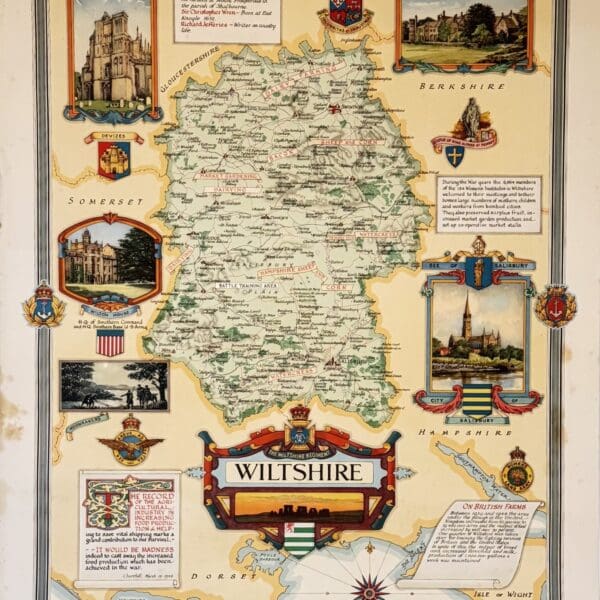
Wiltshire, county map. – Clegg, Ernest
This pictorial map is part of “The Countryman County Maps of Britain” series. Designed and drawn by Ernest Clegg. The maps were commissioned to raise money for the Women’s Land Army Benevolent Fund, providing financial support for the many women volunteers who had contributed to boosting and sustaining food production during the war. Promoted by…
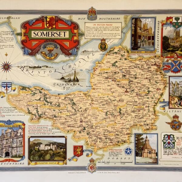
Somerset, county map. – Clegg, Ernest
This pictorial map is part of “The Countryman County Maps of Britain” series. Designed and drawn by Ernest Clegg. The maps were commissioned to raise money for the Women’s Land Army Benevolent Fund, providing financial support for the many women volunteers who had contributed to boosting and sustaining food production during the war. Promoted by…
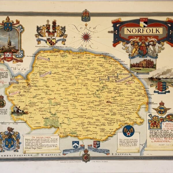
Norfolk, county map. – Clegg, Ernest
This pictorial map is part of “The Countryman County Maps of Britain” series. Designed and drawn by Ernest Clegg. The maps were commissioned to raise money for the Women’s Land Army Benevolent Fund, providing financial support for the many women volunteers who had contributed to boosting and sustaining food production during the war. Promoted by…
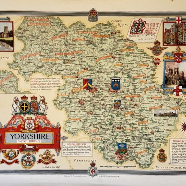
Yorkshire, county map. – Clegg, Ernest
This pictorial map is part of “The Countryman County Maps of Britain” series. Designed and drawn by Ernest Clegg. The maps were commissioned to raise money for the Women’s Land Army Benevolent Fund, providing financial support for the many women volunteers who had contributed to boosting and sustaining food production during the war. Promoted by…
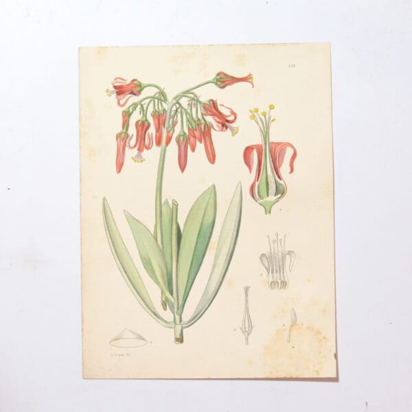
Hand Coloured Plate from The Flowering Plants of South Africa – Veltheimia Roodae –
The first 27 volumes1921 – 1948 had 1080 hand coloured plates. Subsequent volumes have colour lithographed plates. The series is still in publication and is currently on its 70th volume. Each hand coloured plate focuses on a different flowering plant species indigenous to South Africa accompanied by a description of their unique botanical characteristics, habitat…
Hand Coloured Plate from The Flowering Plants of South Africa – Nerine Lucida. –
The first 27 volumes 1921 – 1948 had 1080 hand coloured plates. Subsequent volumes have colour lithographed plates. The series is still in publication and is currently on its 70th volume. Each hand coloured plate focuses on a different flowering plant species indigenous to South Africa accompanied by a description of their unique botanical characteristics,…