Maps, Artifacts, Prints
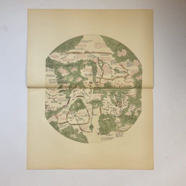
The Zeitz World Map –
A circular mappa mundi believed to be from the late 15th century. This is a 20th century copy. Very good condition, sheet size: 66 x 52cm. Printed on good quality paper, with a central fold. Date Published: c.1950
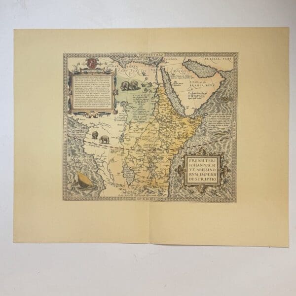
Presbiteri Iohannis Sive Abissino Rum Imperii Descriptio – Ortelius, Abraham
English title: The Description of the Empire of Prester John, or the Abyssinians. Featured in Ortelius’s atlas Theatrum Orbis Terrarum – c. 1570. Considered the first modern atlas. This is a 20th century copy. Very good condition, sheet size: 66 x 52cm. Printed on good quality paper, with a central fold. Date Published: c.1950
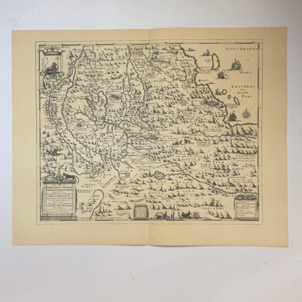
Presbyteri seu Abassia Presbyteri Johannis Regio… – Ludolf, Job
A 17th century map of Abyssinia (Ethiopia), showing the mythical kingdom of Prester John. Based on a chronicle by P Balthazar Tellez. Originally published in 1683, this is a 20th century copy. Very good condition, sheet size: 66 x 52cm. Printed on good quality paper, with a central fold. Date Published: c.1950
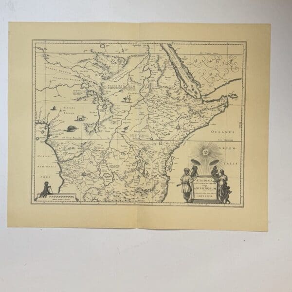
Aethiopia Superior vel Interior vulgo Abissinorum sive Presbiteri Ioannis Imperium – Blaeu, Willem Janzoon
A 17th century map of Ethiopia, originally published c. 1640, this is a 20th century copy. Very good condition, sheet size: 66 x 52cm. Printed on good quality paper, with a central fold. Date Published: c.1950
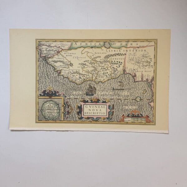
Guineae Nova Descriptio – Hondius, Jodocus
A 17th century map depicting the Gulf of Guinea, extending from modern day Gambia to the coasts of Camaroon and Gabon. Originally published c. 1614, this is a 20th century copy. Very good condition, sheet size: 52 x 33cm. Printed on good quality paper. Date Published: c.1950

Carte Particuliere de la Coste D’Or – Bellin, Nicolas
Map of the Gold Coast of Africa, now part of modern day Ghana. Originally published in 1750, this is a 20th century copy. Very good condition, sheet size: 66 x 52cm. Printed on good quality paper, with a central fold. Date Published: c.1950
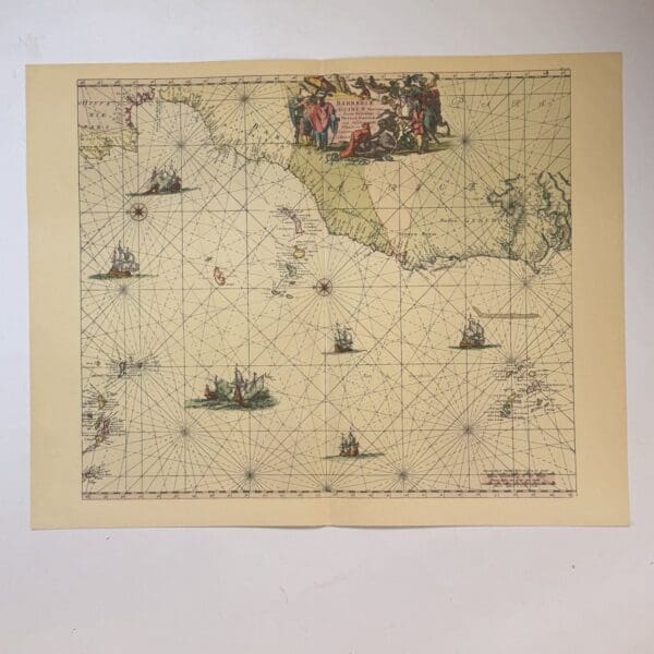
Barbariae et Guineae Maritimi… – Goos, Pieter and De Wit, Frederik
Dutch sea chart of the coast of West Africa. From the strait if Gibralta to the Cape Verde Islands. Originally published c. 1660, this is a 20th century copy. Very good condition, sheet size: 66 x 52cm. Printed on good quality paper, with a central fold. Date Published: c.1950
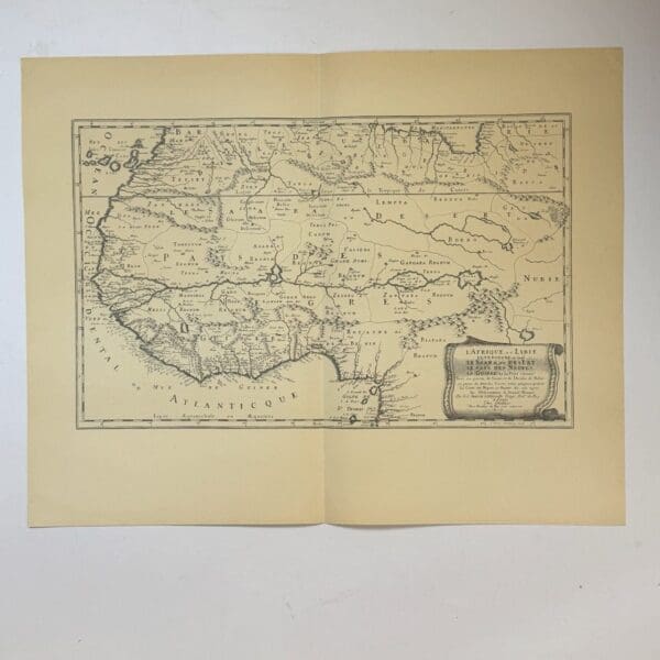
L’Afrique, ou Lybie… – Sanson, Nicolas
Map of North Western Africa and Lybia. Originally published c. 1600, this is a 20th century copy. Very good condition, sheet size: 66 x 52cm. Printed on good quality paper, with a central fold. Date Published: c.1950
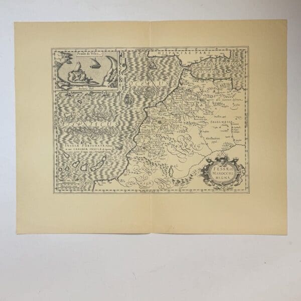
Fessae et Marocchi Regna – Mercator, Gerardus
A 15th century map of the kingdoms of Fez and Morocco. Originally published c. 1620, this is a 20th century copy. Very good condition, sheet size: 66 x 52cm. Printed on good quality paper, with a central fold. Date Published: c.1950
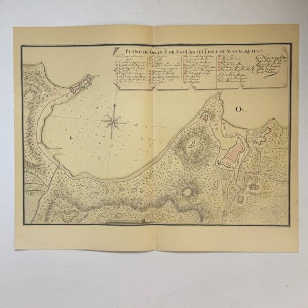
Fessae et Marocchi Plan de Oran y de Sus Castellos y de Masalquivir – Mercator, Gerardus
Copy of a manuscript map of Oran and its castles, and of Mazalquivir, located in present-day Algeria. Likely produced in the 18th century, this is a 20th century copy. Very good condition, sheet size: 66 x 52cm. Printed on good quality paper, with a central fold. Date Published: c.1950

Plan of Algiers – Braun, Georg
Plan of the city of Algiers from the Civitates Orbis Terrarum, a town atlas originally published between 1572 and 1617 This is a 20th century copy. Very good condition, sheet size: 52 x 33cm. Printed on good quality paper. Date Published: c.1950
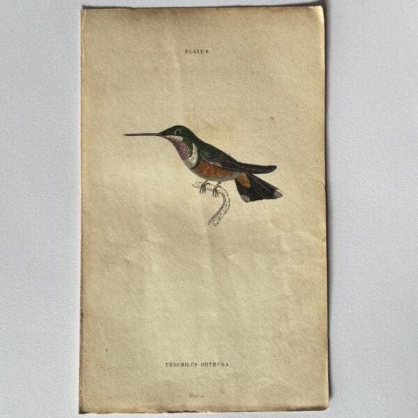
Hand coloured steel engraving from The Natural History of Humming-Birds – Plate 8 – Trochilus Orthura – Jardine, William
Original hand coloured steel engraving, published in 1833. Sheet size: 10.4 x 16.4cm Condition: very good. Publisher: Lizars Date Published: 1833 Publication Place: Edinburgh First Edition: Yes
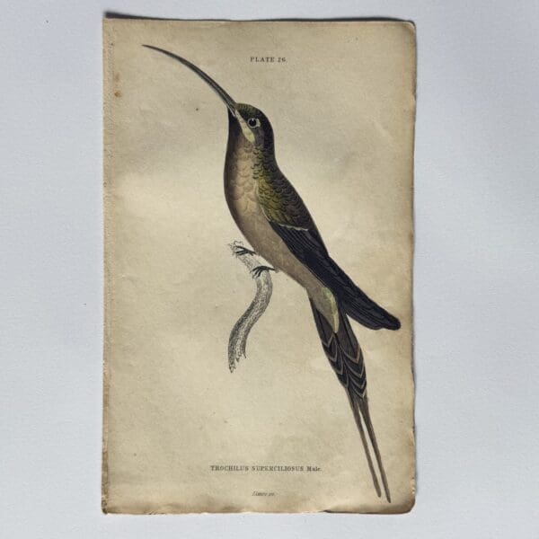
Hand coloured steel engraving from The Natural History of Humming-Birds – Plate 26 – Trochilus Superciliousus Male – Jardine, William
Original hand coloured steel engraving, published in 1833. Sheet size: 10.4 x 16.4cm Condition: very good. Publisher: Lizars Date Published: 1833 Publication Place: Edinburgh First Edition: Yes

Hand coloured steel engraving from The Natural History of Humming-Birds – Plate 12 – Trochilus Underwoodii – Jardine, William
Original hand coloured steel engraving, published in 1833. Sheet size: 10.4 x 16.4cm Condition: very good. Publisher: Lizars Date Published: 1833 Publication Place: Edinburgh First Edition: Yes

Hand coloured steel engraving from The Natural History of Humming-Birds – Plate 15 – Trochilus Tricolor – Jardine, William
Original hand coloured steel engraving, published in 1833. Sheet size: 10.4 x 16.4cm Condition: very good. Publisher: Lizars Date Published: 1833 Publication Place: Edinburgh First Edition: Yes

Hand coloured steel engraving from The Natural History of Humming-Birds – Plate 26 – Trochilus Eurynome – Jardine, William
Original hand coloured steel engraving, published in 1833. Sheet size: 10.4 x 16.4cm Condition: very good. Publisher: Lizars Date Published: 1833 Publication Place: Edinburgh First Edition: Yes

Hand coloured steel engraving from The Natural History of Humming-Birds – Plate 16 – Trochilus Waglerii – Jardine, William
Original hand coloured steel engraving, published in 1833. Sheet size: 10.4 x 16.4cm Condition: very good. Publisher: Lizars Date Published: 1833 Publication Place: Edinburgh First Edition: Yes

Hand coloured steel engraving from The Natural History of Humming-Birds – Plate 4- Trochilus Cligena – Jardine, William
Original had coloured steel engraving, published in 1833. Sheet size: 10.4 x 16.4cm Condition: very good. Publisher: Lizars Date Published: 1833 Publication Place: Edinburgh
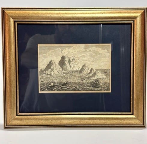
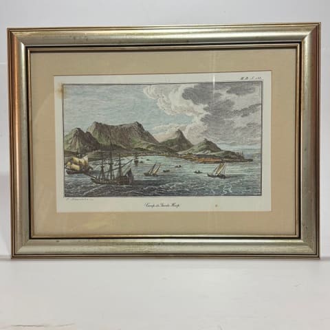
View of the Cape of Good Hope. – Thunderberg, Carl Peter
View of the Cape of Good Hope from travels to Europe, Africa and Asia 1772/1775. Image size: 16.2 x 10.5 cm. Framed size: 32 x 27 cm. Very Good. Date Published: 1795 Condition: Very Good.
Caap de Goede Hoop. –
View of Cape of Good Hope, 20th century. Size: Plate 32 x 20.5 cm. Framed size: 46 x 34.5 cm. Reprint. Very Good. Condition: Very Good.
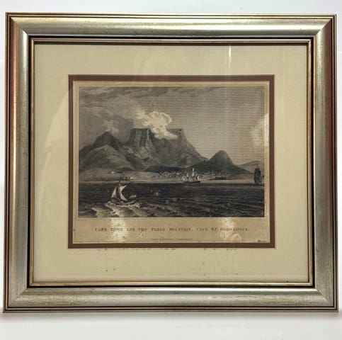
Cape Town and the Table Mountain, Cape of Good Hope. – Craig, William Marshall
Engraving of Cape Town and the Table Mountain, Cape of Good Hope. Plate size: 24.5 x 21 cm. Framed size: 39.5 x 36 cm. Fair. Some foxing and discolouration. See image. Date Published: 1816 Condition: Fair.
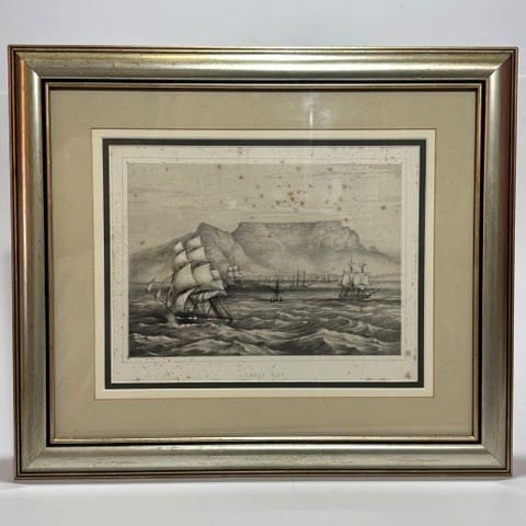
Table Bay – Anderson, John Corbet
Lithograph of Table Bay. Plate size: 26 x 20.5cm. Framed size: 43.5 x 37.5 cm. Fair. Some foxing, see image. Date Published: 1858 Condition: Fair.
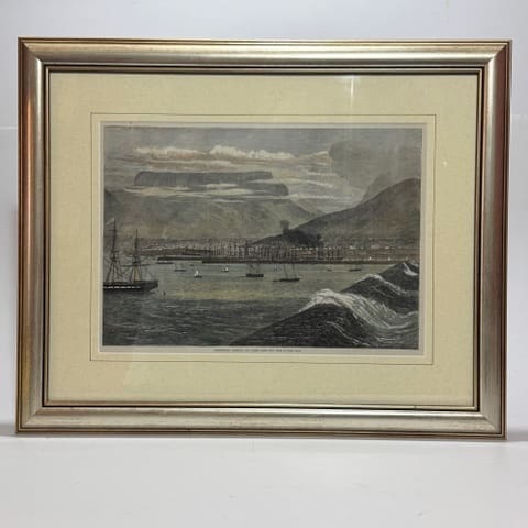
Breakwater Harbour, and Docks, Table Bay, Cape of Good Hope. – No author specified.
Hand tinted steel engraving of Breakwater and harbour. Plate size: 35 x 25.5cm. Framed size: 53 x 43.5 cm. Very good. Date Published: Circa 1870 Condition: Very good.
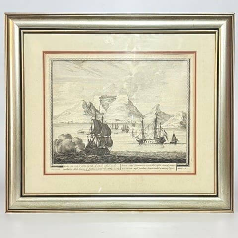
Kabo de Bona Esperanza – Schenk, (the younger)
Copper plate engraving of Table Bay, Cape Town, uncoloured. Size: Plate mark 26.6 x 21.8 cm. Framed size: 32.5 x 27 cm. Reprint. Very Good. Date Published: Circa 1750 Condition: Very Good.
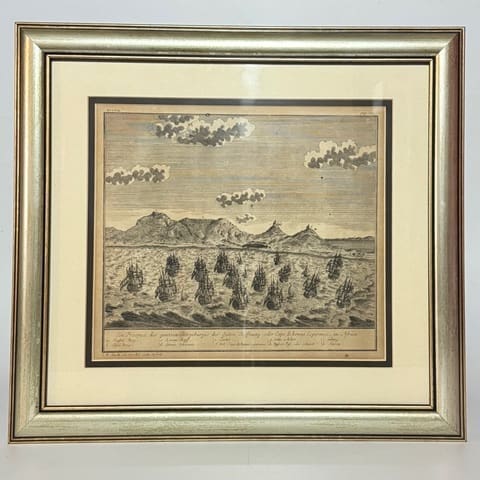
Ein Prospect des gantzen Vorgeburger… – Heydt Wolfgang, Johann
View of Table Mountain and Table Bay. Reprint. Very good, some age toning and a few spots. Map. Size: plate mark 28 x 24.6 cm. Framed size: 34 x 30 cm. Reprint. Very good, some age toning and a few spots. Date Published: 1966 Condition: Very good.
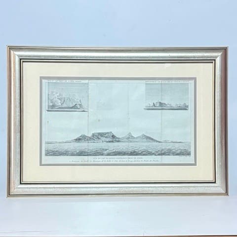
Vue de cap de Bonne-Esperance Prise en Rade. – Le Vaillant, Francois
Engraving from Le Vaillant’s travels inset of view of Table Mountain with its tablecloth from Robben Island. Size: Plate mark 34 x 19 cm. Framed size: 49.5 x 34 cm. Good, 3 spots of foxing. Date Published: Circa 1796 Condition: Good.
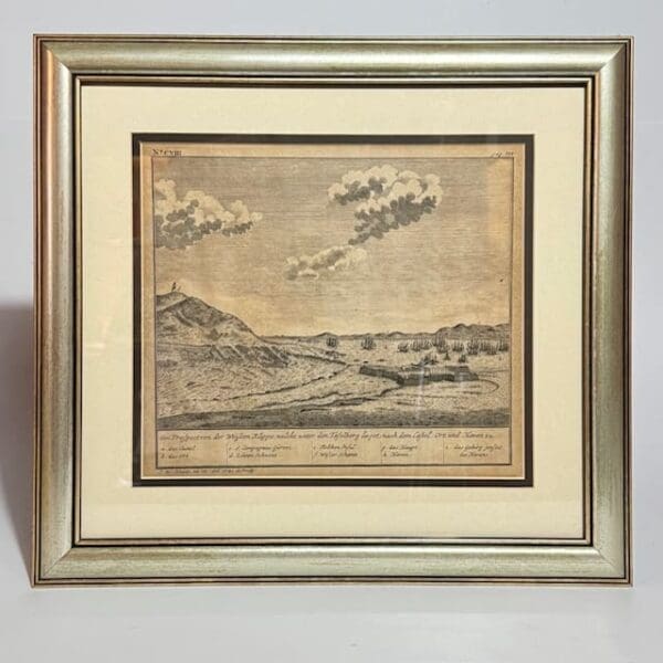
Ein Prospectvon der Wiessen Klippe, welche unter den Tafelberg lieget, nach dem tafel, ort und Haven zu. – Heydt Wolfgang, Johann
The Castle and Settlement at the Cape. Size: Neat lines 23 x 26.5 cm. Framed size: 42.5 x 40 cm. Reprint. Very Good. Date Published: 1966 Condition: Very Good.
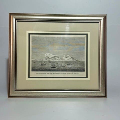
View of the mountains at the Cape of Good-Hope, covered with Clouds on the South East. – Heath
An interesting view showing the table cloth on Table Mountain. Image size 25.2 x 20 cm. Framed size: 43.5 x 37 cm. Very Good. Date Published: Circa 1780 Condition: Very Good.
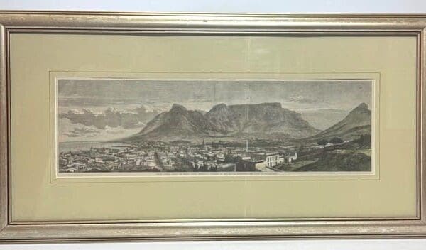
Cape Town, Cape of Good Hope, recently visited by His Royal Highness the Duke of Edinburgh. – No author specified.
Hand coloured steal engraving from London Illustrated magazine, 28th September 1867. Image size: 15.8 x 52 cm. Framed size: 37.5 x 73.5 cm. Very Good, barring a few spots in the sky. Date Published: 1867 Condition: Very Good

The Cape of Good Hope. – None specified
The Cape of Good Hope, a primitive view of Table Bay and mountains. Size: plate mark 19 x 12 cm. Framed size: 27 x 34.5 cm. Very good with some age toning. Date Published: 1754 Condition: Very good.