Maps, Artifacts, Prints
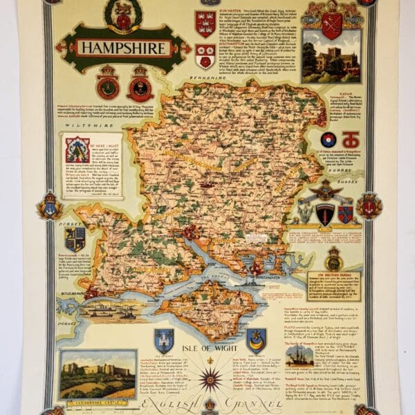
Hampshire, county map. – Clegg, Ernest
This pictorial map is part of “The Countryman County Maps of Britain” series. Designed and drawn by Ernest Clegg. The maps were commissioned to raise money for the Women’s Land Army Benevolent Fund, providing financial support for the many women volunteers who had contributed to boosting and sustaining food production during the war. Promoted by…
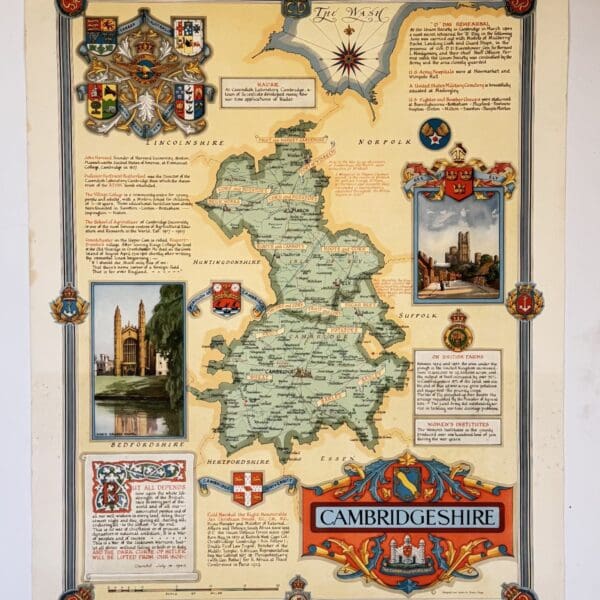
Cambridgeshire, county map. – Clegg, Ernest
This pictorial map is part of “The Countryman County Maps of Britain” series. Designed and drawn by Ernest Clegg. The maps were commissioned to raise money for the Women’s Land Army Benevolent Fund, providing financial support for the many women volunteers who had contributed to boosting and sustaining food production during the war. Promoted by…
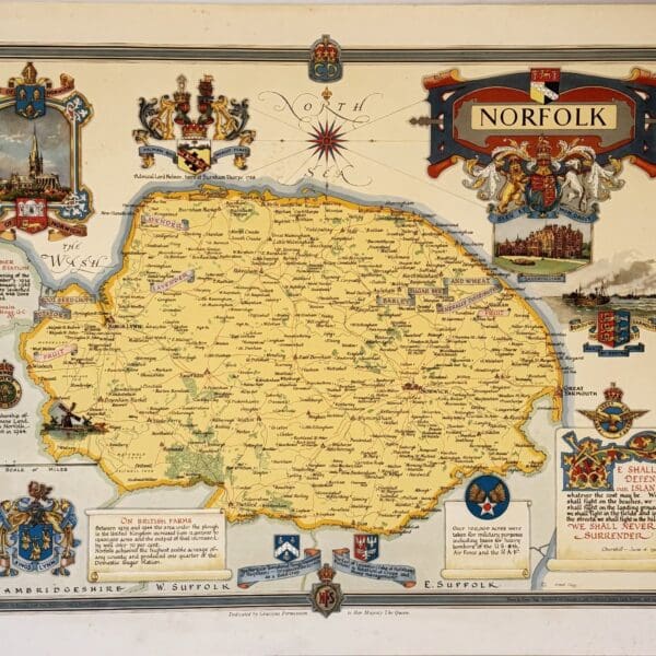
Norfolk, county map. – Clegg, Ernest
This pictorial map is part of “The Countryman County Maps of Britain” series. Designed and drawn by Ernest Clegg. The maps were commissioned to raise money for the Women’s Land Army Benevolent Fund, providing financial support for the many women volunteers who had contributed to boosting and sustaining food production during the war. Promoted by…
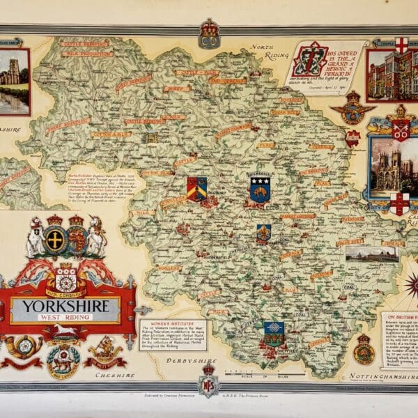
Yorkshire, county map. – Clegg, Ernest
This pictorial map is part of “The Countryman County Maps of Britain” series. Designed and drawn by Ernest Clegg. The maps were commissioned to raise money for the Women’s Land Army Benevolent Fund, providing financial support for the many women volunteers who had contributed to boosting and sustaining food production during the war. Promoted by…
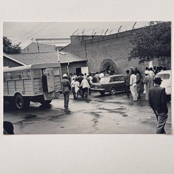
Vintage Gelatin Silver Print from House of Bondage – Cole, Ernest
A vintage print, 16.2 x 24.2cm. Very good condition, slight signs of wear to the edges. Stamps of the ABC Press,Amsterdam and Magnum Photos, N.Y.C. to the verso. This image appears in Cole’s important 1967 photobook, House of Bondage with the following caption: “Every morning police trucks from all over the city (Johannesburg) and surrounding…

Barbariae et Biledvlgerid, Nova Descriptio – Ortelius, Abraham
North Africa, originally published c. 1570, this is a 20th century copy. Very good condition, sheet size: 52 x 33cm. Printed on good quality paper. Date Published: c.1950

Antique Sea Chart – Coast of Africa –
Copy of an early masnuscript chart, probably 15th or 16th century, this is a 20th century copy. Very good condition, sheet size: 66 x 52cm. Printed on good quality paper, with a central fold Date Published: c.1950

3 Early Charts of the African Coast –
This is a 20th century copy. Very good condition, sheet size: 66 x 52cm. Printed on good quality paper, with a central fold Date Published: c.1950

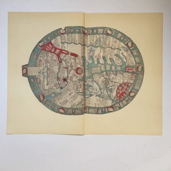
Map of the World – Germanus, Henricus Martellus
The first known map to show the Cape of Good Hope, discovered by Bartholemeu Dias in 1488. This is a 20th century copy. Very good condition, sheet size: 66 x 52cm. Printed on good quality paper, with a central fold Date Published: c.1950
Tunis at La Goulette – Braun, Georg
Copy of an engraving of the Ottoman fleet attacking Tunis at La Goulette in 1574. Originally published in Civitates Orbis Terrarum 1572 – 1617, this is a 20th century copy. Very good condition, sheet size: 52 x 33cm. Printed on good quality paper. Date Published: c.1950

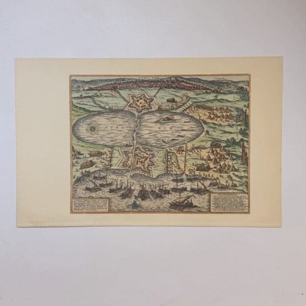
St. Helena Island – Dapper
Published c. 1677, this is a 20th century copy. Very good condition, sheet size: 66 x 52cm. Printed on good quality paper, with a central fold Date Published: c.1950
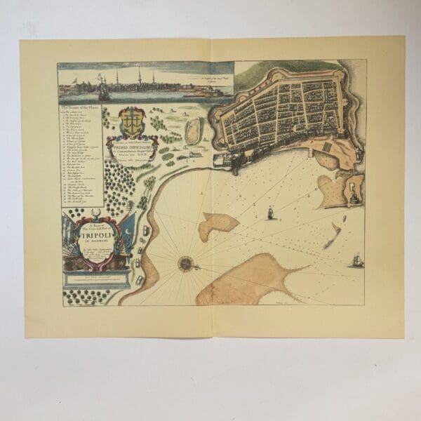
A Mapp of The Citie and Port of Tripoli in Barbary – Seller, John
Originally published c.1675, this is a 20th century copy. Very good condition, sheet size: 66 x 52cm. Printed on good quality paper, with a central fold Date Published: c.1950
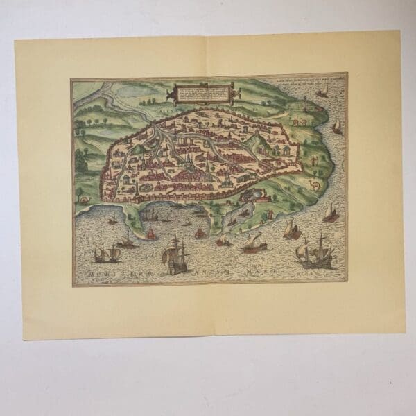
Plan of Alexandria – Egypt – Braun, Georg.
Originally form Braun’s Civitates Orbis Terrarum, published c.1597, this is a 20th century copy. Very good condition, sheet size: 66 x 52cm. Printed on good quality paper, with a central fold Date Published: c.1950
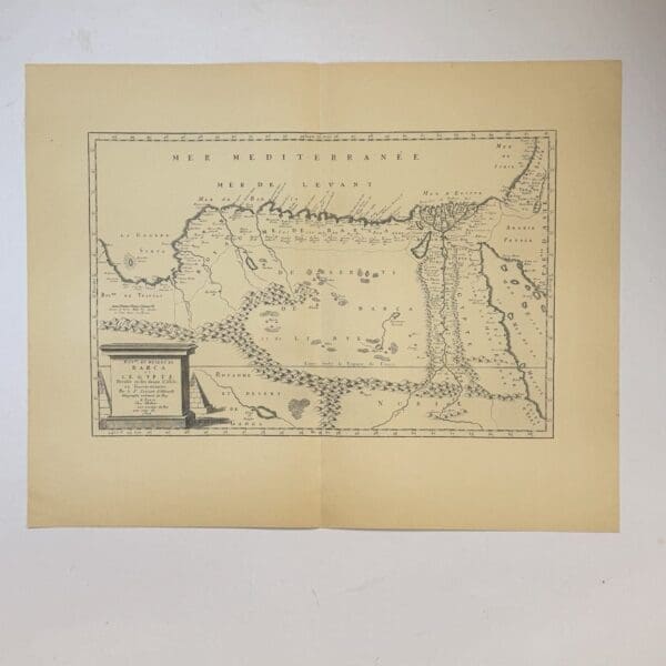
Barca et L’Egypte… – Sanson, Nicolas
17th century French map of Egypt. Originally published c. 1679, this is a 20th century copy. Very good condition, sheet size: 66 x 52cm. Printed on good quality paper, with a central fold Date Published: c.1950
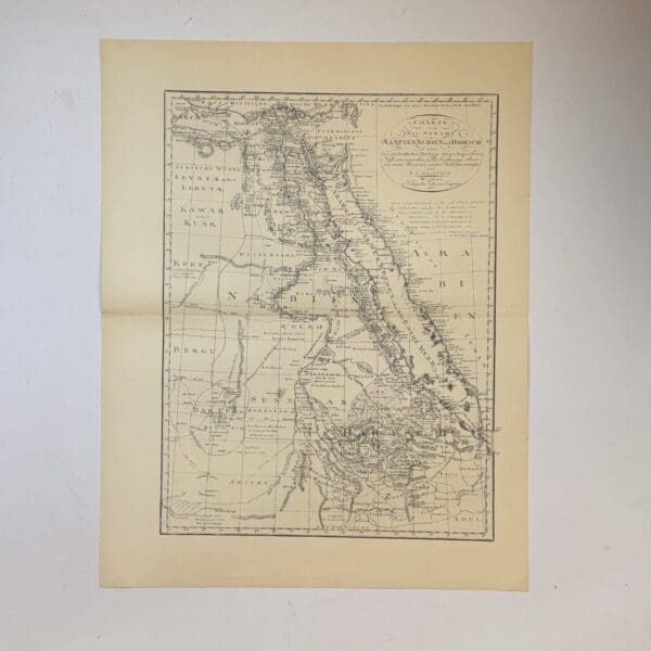
Charte vom Nil Strome Aegypten, Nubien und Habesch… – Gullefeld, F.L.
Map of the Nile River, Egypt, Nubia and Abyssinia Originally published in 1800, this is a 20th century copy. Very good condition, sheet size: 66 x 52cm. Printed on good quality paper, with a central fold Date Published: c.1950
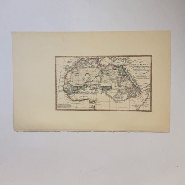
Charte von Nord Africa… – Rennell, J.
German map of North Africa,Originally published c. 1798, this is a 20th century copy. Very good condition, sheet size: 52 x 33cm. Printed on good quality paper. Date Published: c.1950
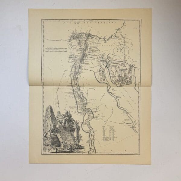
Carte de L’Egypte Ancienn et Moderne. – Vaugondy, Robert de
18th century French map of Ancient Egypt showing the Nile river and its delta. Originally published c. 1753, this is a 20th century copy. Very good condition, sheet size: 66 x 52cm. Printed on good quality paper, with a central fold Date Published: c.1950
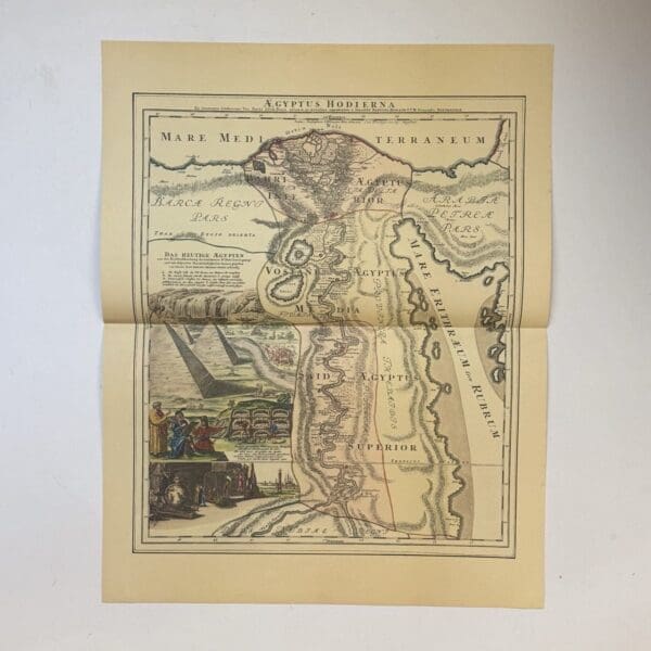
Aegyptus Hodiera – Homann, Johann
German map showing the course of the Nile River with exaggerated detail, based on the travels of Paul Lucas. A French merchant and antiquarian Originally published c. 1753, this is a 20th century copy. Very good condition, sheet size: 66 x 52cm. Printed on good quality paper, with a central fold Date Published: c.1950
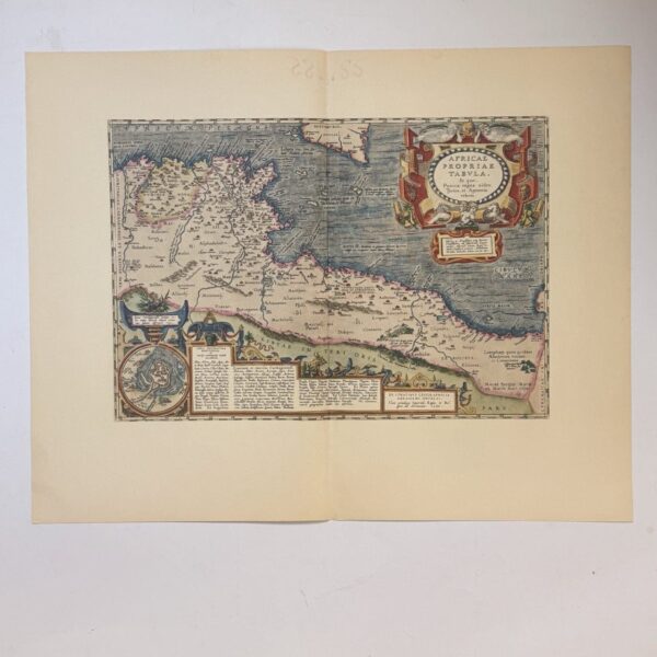
Africae Propriae Tabula – Ortelius, Abraham
Showing ancient North Africa, specifically focusing on the Carthaginian Kingdom during the Punic Wars. Originally published c. 1603, this is a 20th century copy. Very good condition, sheet size: 66 x 52cm. Printed on good quality paper, with a central fold Date Published: c.1950

Carte De La Barbarie De La Nigritie Et De La Guinee – L’Isle, Guillaume
Map of North Africa and the Barbary Coast. Originally published c. 1707, this is a 20th century copy. Very good condition, sheet size: 66 x 52cm. Printed on good quality paper, with a central fold Date Published: c.1950

Nova Barbariae Descriptio – Schenk and Valk
Map of North Africa – Description of Barbary. Originally published c. 1700, this is a 20th century copy. Very good condition, sheet size: 52 x 33cm. Printed on good quality paper. Date Published: c.1950
Tertia Africae Tabula – Waldseemuller, Martin
North Africa, originally published c. 1513, this is a 20th century copy. Very good condition, sheet size: 52 x 33cm. Printed on good quality paper. Date Published: c.1950
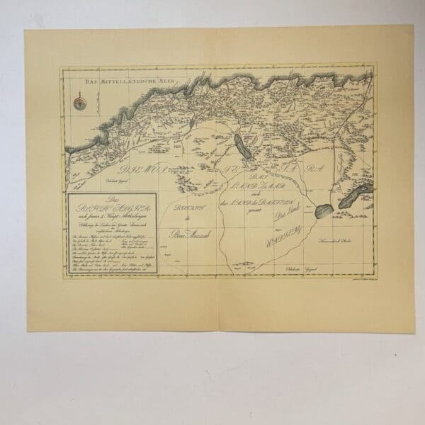
Das Reich Algier –
A German map of the Kingdom of Algiers. Originally published in 1798, this is a 20th century copy. Very good condition, sheet size: 66 x 52cm. Printed on good quality paper, with a central fold. Date Published: c.1950
14th Century Map from the Polychronicon – Higden, Ranulf
A 20th century copy. The original was drawn c.1539. Very good condition, sheet size: 66 x 52cm. Printed on good quality paper, with a central fold. Date Published: c.1950 Condition: Very good condition
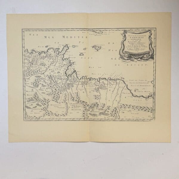
Partie de la Coste de Barbarie en Africque… – Sanson, Nicolas
17th century French map of part of the coast of Barbary showing the kingdoms of Tunis and Trippoli. Originally published in 1655, this is a 20th century copy. Very good condition, sheet size: 66 x 52cm. Printed on good quality paper, with a central fold Date Published: c.1950
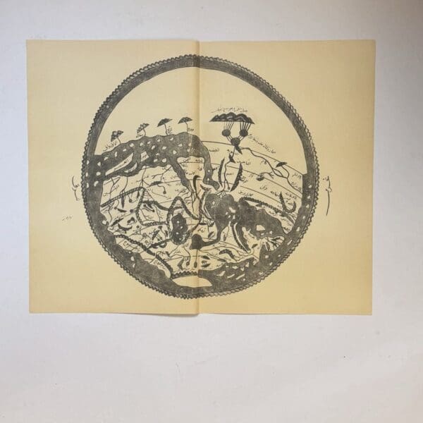
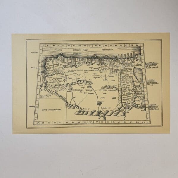
The Tabula Rogeriam – al-Idrisi, Muhammad
A 20th century copy. The original was drawn c.1154 Very good condition, sheet size: 66 x 52cm. Printed on good quality paper, with a central fold. Date Published: c.1950
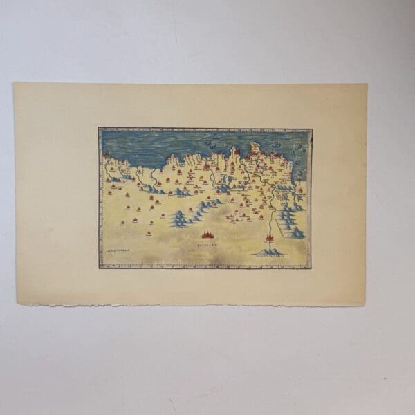
Part of North Africa –
Copy of an unidentified manuscript map of North Africa from the 15th or 16th century. This is a 20th century copy. Very good condition, sheet size: 52 x 33cm. Printed on good quality paper. Date Published: c.1950
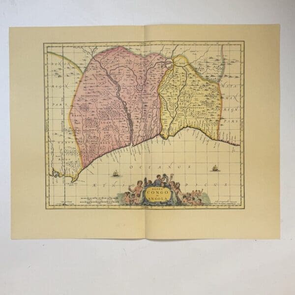
Regna Congo et Angola – Schenk
A 17th century map of Congo and Angola. A 20th century copy. The original was first published in 1660 and re-issued many times. Very good condition, sheet size: 66 x 52cm. Printed on good quality paper, with a central fold. Date Published: c.1950
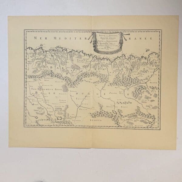
Partie de la Barbarie ou est le Royaume D’Alger – Sanson, Nicolas
The Kingdom of Algiers. Originally published c.1679, this is a 20th century copy..Very good condition, sheet size: 66 x 52cm. Printed on good quality paper, with a central fold Date Published: c.1950
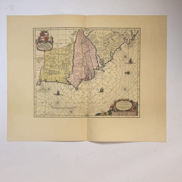
Genehoa, Jaloffi, et Sierraliones Regna – Jansson, Jan
A nautical chart of the West African coast. Covering from Senegal to Sierra Leone, with a focus on the area around the Gambia River. Originally published c. 1665, this is a 20th century copy. Very good condition, sheet size: 66 x 52cm. Printed on good quality paper, with a central fold. Date Published: c.1950