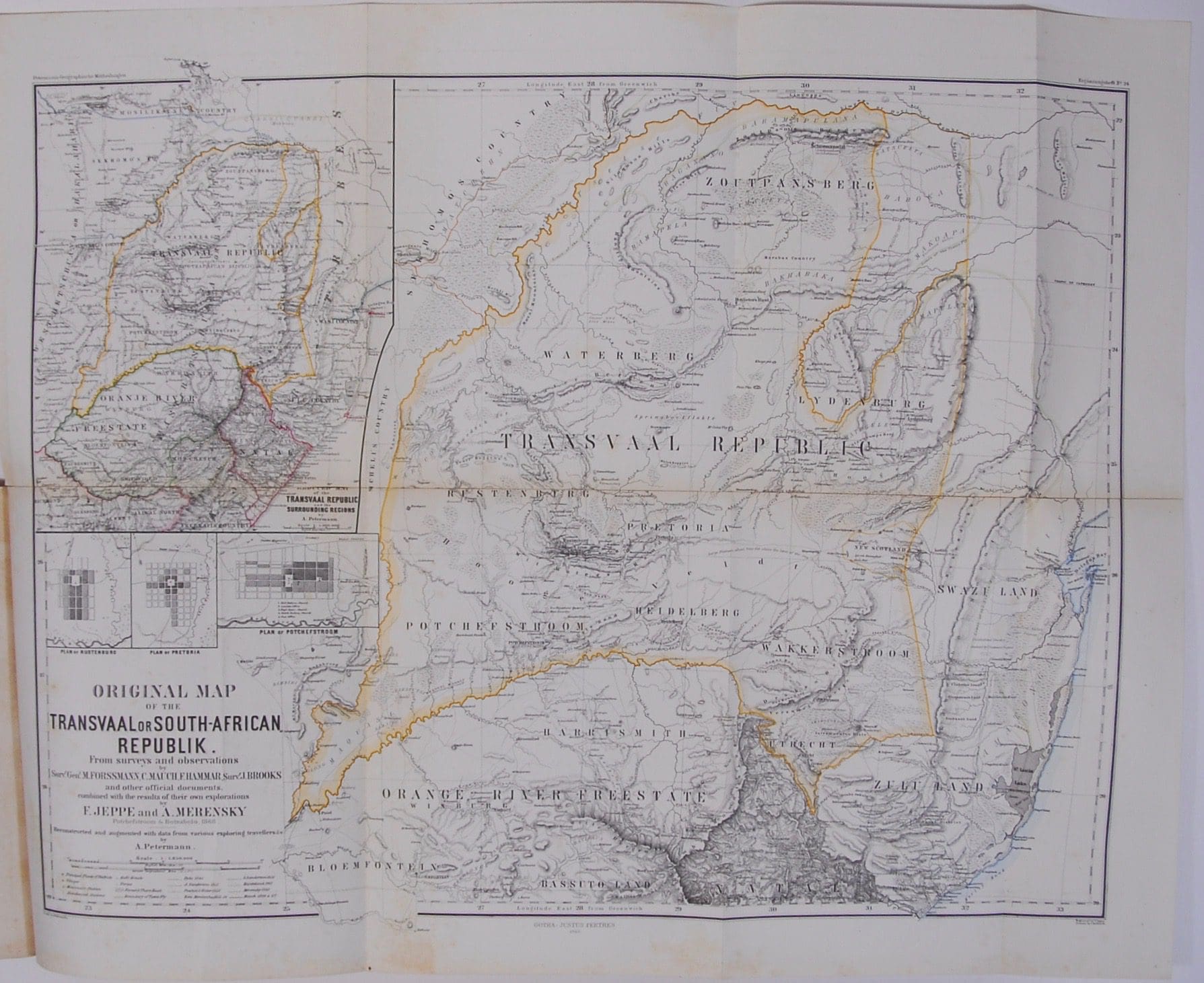


With an appendix: Dr Wangemann’s Reise in Sud-Afrika 1866-67 and an original map of the Transvaal Republic. It was the first topographic map of the territory compiled locally from farm diagrams and other information, including a compilation started in 1866 by Carl Mauch. Reinforcing with clear tape to centre fold of map. Tidemarks. Light scattered foxing throughout contents. Map has some light foxing on the verso and the margins of the maps.
Publisher: Justus Perthes
Date Published: 1868
Publication Place: Gotha
Condition: Good
Binding: Softcover. Thick card wraps with bright gilt lettering to cover.
Additional information
| Weight | 300 g |
|---|
You Might Also Like

Wanderungen und Kamfe in Sudwest-afrika, Ostafrika und Sudafrika 1894 – 1910 – Van Estorff, Ludwig. Kutscher, Christoph-Friedrich (Ed)
R550.00
Add to basket

Die Transvaal’sche oder Süd-Afrikanische Republik. – Jeppe, Friedrich
R3,300.00
Add to basket

Tunis, Kairouan & Carthage – Petrie, Graham
R528.00
Add to basket

Le Grand Desert Itineraire D’Une Caraven du Sahara au Pays des Negres. Royaume de Haoussa. – Le General Daumas
R495.00
Add to basket