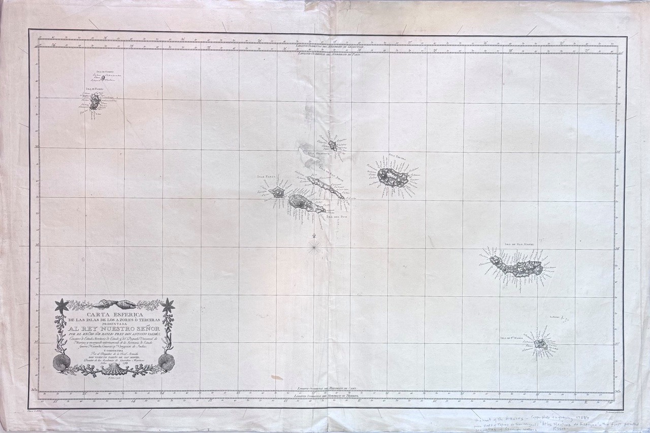
This chart by Vincente Tofino, a prominent Spanish cartographer, is from the “Atlas Maritimo de Espana” and engraved by F. Selma. The chart focuses on the Azores Islands, a crucial mid-Atlantic archipelago for navigation during the Age of Sail. Condition: good. Neatly repaired central damage with small amount of repaired loss. Copper plate engraving on heavy laid paper.
Date Published: 1788
Publication Place: Madrid
First Edition: Yes
Condition: Good
Dimensions: 96 63.5cm