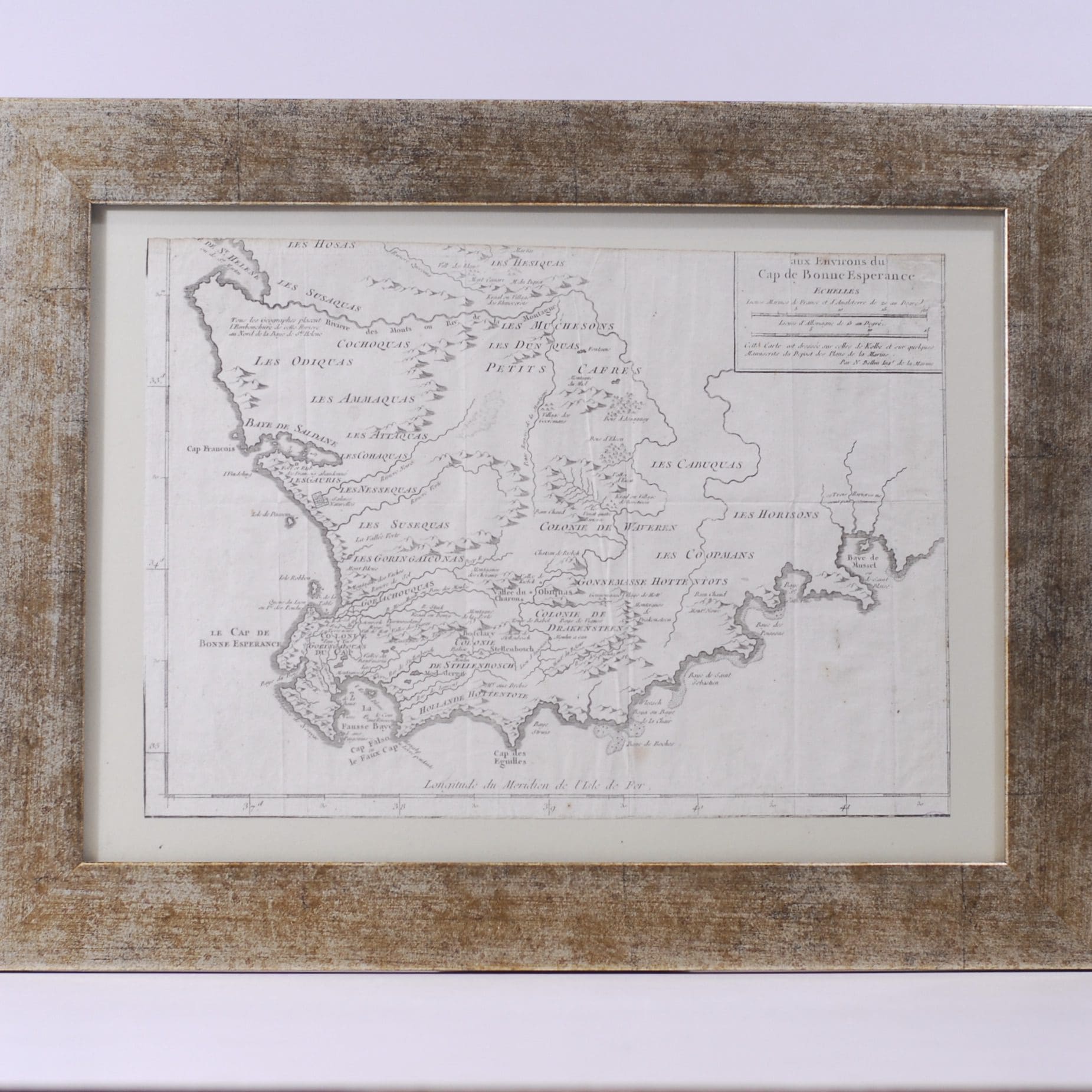
Detailed map of a portion of South Africa, from Baye de St. Helen and Baye Saldane in the West, to Baye de Musssel in the East. Shows tribes, rivers, towns, mountains, lakes, bays and a host of other details. Trimmed to the left and bottom borders. The right side trimmed to the neatline and the top edge heavily trimmed, removing the top line of the title of the map. Laid down on card. Some creases. Condition: poor due to the trimmed edges.
Date Published: 1757
Dimensions: 33 x 24.5cm
Additional information
| Weight | 1100 g |
|---|