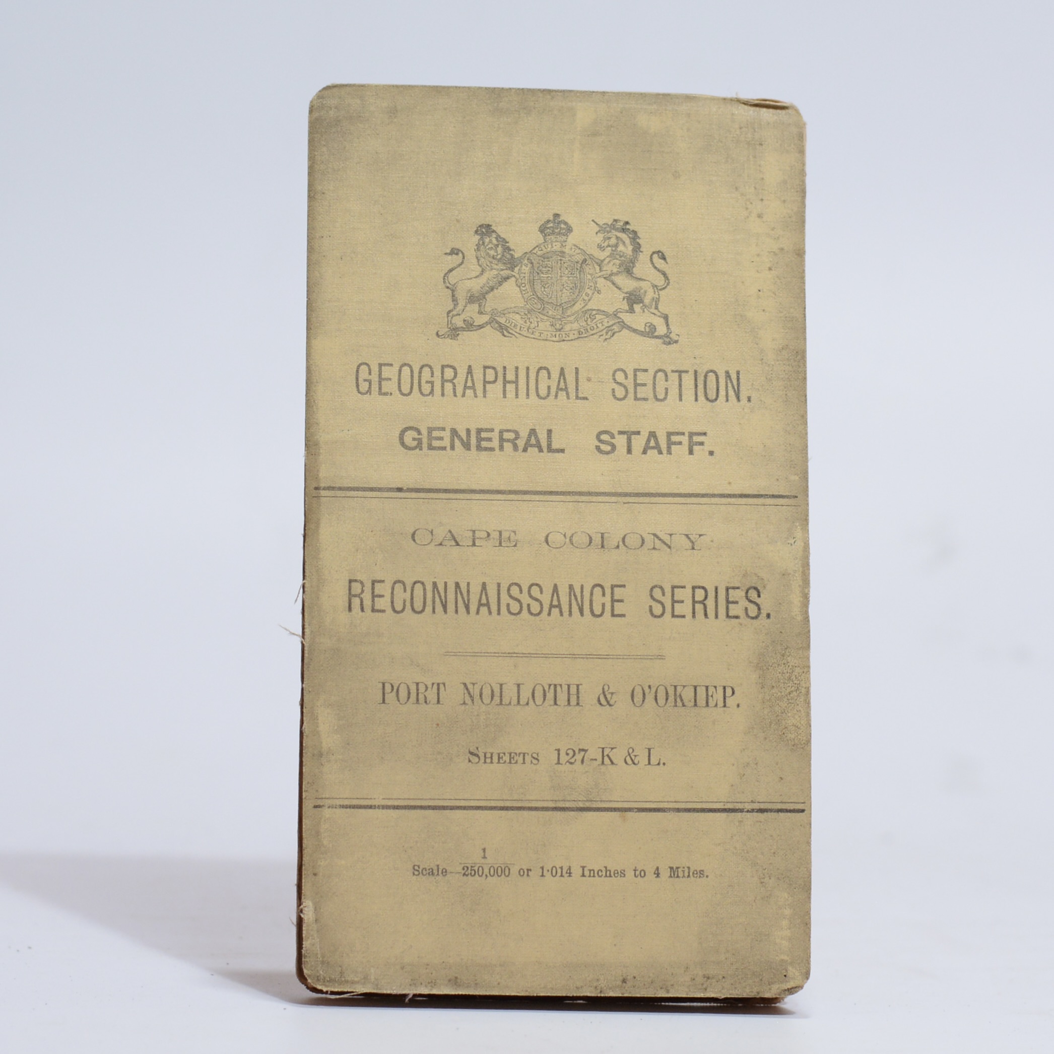
A detailed map of the area at a scale of 1:250 000 with insets of Port Nolloth & O’Okiep. A key noting towns, villages with locations, boundaries, railways, roads frequented by wagons, unfrequented, bridle and steep or heavy gates, farm beacons and numbers, kraals and ruins. wind pumps, rivers, water pipes etc. Also a table of 22 halting places, showing wet or dry season suitability, water, grazing, fuel and a column for rewards. Size: 60.5 x 63.5cm First Edition. Condition: Very good. Dust marks to the outside wraps. Binding: Softcover. Cardwraps.
Publisher: The War Office
Date Published: 1907
First Edition: Yes
Condition: Very good. Dust marks to the outside wraps.
Binding: Softcover. Cardwraps.
You Might Also Like

Direcão dos Serviços de Obras Públicas E Transportes. Mapa Rodoviario. –
R770.00
Add to basket

Sudwestafrika – eine geographische Landeskunde. – Leser, Hartmut
R165.00
Add to basket
Der Erongo. Geowissenschaftliche Beschreibung und Deutung eines sudwestafrikanischen Vulkankomplexes. – Blumel, Wolf Dieter; Emmermann, Rolf and Huser, Klaus
R330.00
Add to basket
Cape Colony Reconnaissance Series. Strydenburg Sheet: 128-L –
R1,650.00
Add to basket