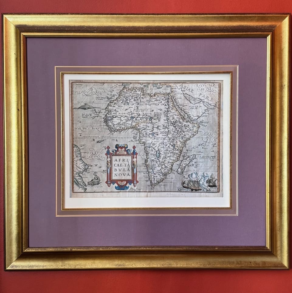

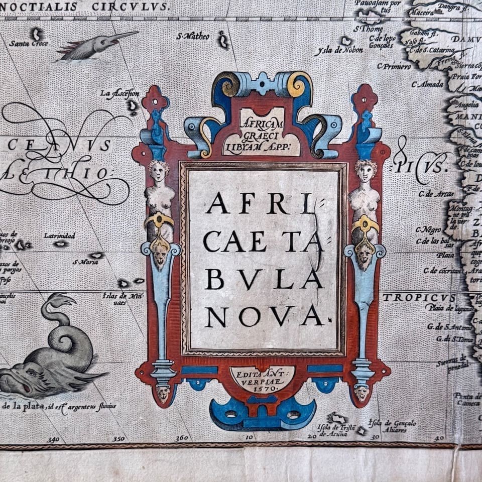
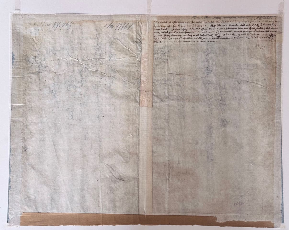
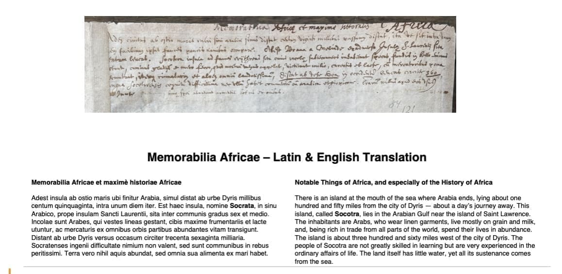
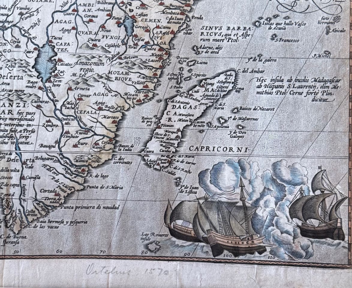
Ortelius’s Africa – the Fifth State, published 1595-98. This map is from Ortelius’s atlas Theatrum Orbis Terrarum, first published in 1570. Thirty one editions appeared between 1570 and 1612, six of them after his death in 1598. At the time of its publication it was the most expensive book ever produced. The same copper plate was used for this map throughout this period, during which it was re-engraved a number of times. By 1595 a crack had begun to appear on the right side of the title cartouche, working its way down over the following years. Maps by Ortelius in circulation come from broken up atlases, except for a few copies without text on the verso. These must either date from before the first atlas edition of 1570 when loose map sheets are known to have been sold. A minuscule number of Ortelius maps are blank on the verso as is this one, probably individually struck in 1595 – 1958 and then bound in a composite atlas, rather than the Theatrum Orbis Terrarium. An interesting early handwritten inscription has been added to the blank verso. Written in ink, the Latin script appears to be from the period. An attempt has been made to transcribe and translate this early text, as can be seen in one of the supplied images. The island referred to as Socotra in this translation appears on the map by its earlier spelling as Zacototera. It can be found close to the eastern edge of the 10th degree north line of latitude. The translation is inaccurate but gives one the gist of the meaning. Dyris is referred to as being a days journey of 150 miles distant. Further along it is indicated as being 350 miles west of the island. Dyris is mentioned by some early historians – Herodotus among them, but its precise location remains unknown – possibly eastern Lybia or in the region of the Atlas. Socotra is a Yemeni island. An attempt was made in 1507 by a Portuguese fleet, commanded by Tristao de Cunha to occupy the port of Suq on Socotra island. Their objective was to set a base in a strategic place on the route to India. Famine and sickness lead to a short occupation, though foreign interest may have continued and hence this inscription about 100 years later. “This beautiful map is one of the cornerstone maps of Africa. It generally replaced the maps of Sebastian Munster and Mercator and remained the standard map of Africa well into the seventeenth century” (Betz) Condition: Good. Colour appears to be early but unlikely to be contemporary. The plate mark is clear, some fraying to the margins and a short repaired tear extends from the lower margin of the centrefold. Some old paper tape to the bottom edge, the other three edges reinforced with tissue. Left hand margin trimmed close to the platemark. Other three margins are generous. Size: 50.3 x 37.5cm to the neat lines and 96.5 x 86.5cm framed size. This item to be removed from the frame for international shipping.
Date Published: 1595-98
Publication Place: [Antwerp]
You Might Also Like